


An all new edition of the ABC 33/40 Weather Xtreme video is available in the player on the right sidebar of the blog. You can subscribe to the Weather Xtreme video on iTunes by clicking here.
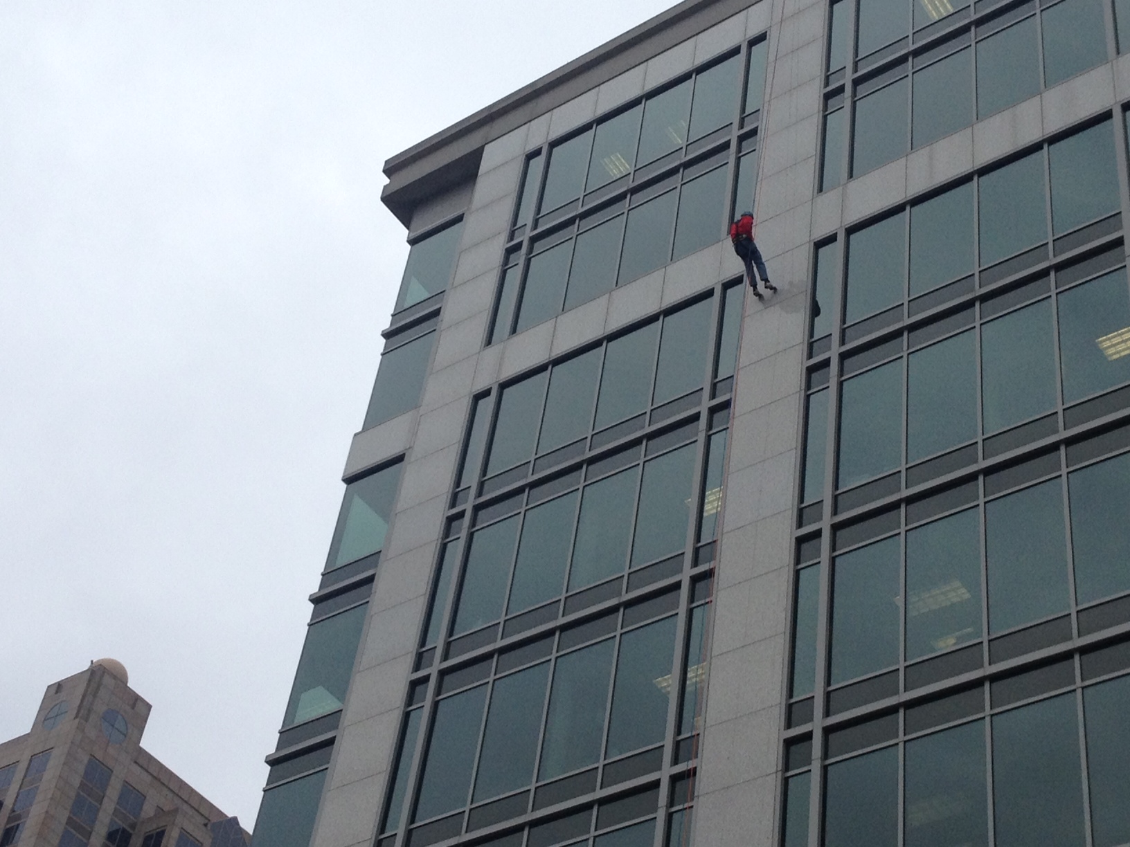
OVER THE EDGE: Had a great time today rappelling down the One Federal Place building today in downtown Birmingham… this is a fund raiser for Cystic Fibrosis research. Please consider helping me reach my goal… check it out here.
SHOWERY WEATHER: Occasional showers are likely across North/Central Alabama tonight and tomorrow ahead of a strong cold front, that has just passed through Memphis. The rain won’t be especially heavy, but you will have some raindrops at times for the next 24 hours or so. Additional rain amounts will be less than 1/2 inch.
COLD AIR BLAST: As the cold front moves through tomorrow, strong north winds will develop by afternoon of 12-25 mph, and temperatures will begin to fall. We begin the day in the 50s tomorrow morning, but we fall into the 40s during the afternoon hours, and the strong north wind will make it feel colder. A very raw November day.
The sky clears tomorrow night, and by Sunday morning we drop into the mid 20s. But, the wind keeps up, and the wind chill index early Sunday will drop down to around 10 degrees. Sunday will be sunny, but windy and cold with a high only in the low 40s; the GFS and the NAM are both printing a high of 43 degrees for Birmingham.
Sunday night will be very cold, but the wind dies down. We drop into the mid 20s early Monday, but colder valleys could see upper teens or low 20s.
FOOTBALL WEATHER: Showers are a possibility for tonight’s high school football playoff games with a cloudy sky and temperatures in the 50s. Higher chance of rain for the games will be north of Birmingham, especially north of U.S. 278.
Saturday, Alabama hosts UT-Chattanooga at Bryant-Denny Stadium (1:00p CT kickoff); the afternoon will be cloudy and windy with temperatures falling from the mid 50s at kickoff into the upper 40s during the fourth quarter. North winds will increase to 12-25 mph late in the game. Some light rain is possible, especially during the first half.
PRE-THANKSGIVING STORM: Clouds increase Monday ahead of a major storm system in the northern Gulf of Mexico. We will have to watch the beginning and end of the precipitation shield as there is some potential for wintry weather over the northern quarter of Alabama.
MONDAY NIGHT/EARLY TUESDAY: Evaporative cooling could bring temperatures down to near the freezing mark. And, as precipitation begins in the dry air, I fully expect some sleet reports Monday night and early Tuesday. The cold air could be deep enough for a few snow flakes over far North Alabama (mainly north of the Tennessee River) Monday night. For now I don’t expect any significant travel issues, but we will watch this situation very closely over the weekend since so many people will be on the road next week for the Thanksgiving holiday.
TUESDAY SOAKER: Looks like we have a soaking rain pretty much all day Tuesday as the surface low passes to the south. Rain amounts of 1 to 2 inches are likely, and some South Alabama communities could go over two inches. Temperatures will hold in the chilly 40s all day with a strong east wind on the northern periphery of the surface low.
WEDNESDAY: The next issues comes as the storm moves northeast, and more cold air is pulled down into Alabama. A brief period of sleet or snow is possible Wednesday morning over far North Alabama, but again at this point we don’t expect any travel issues. Otherwise, some lingering light rain is possible Wednesday morning as energy is transferred to a new surface low forming near the Atlantic coast. Rain will end later in the day Wednesday, and the sky will clear here Wednesday night.
ATTENTION TRAVELERS: The low moving up the Atlantic coastline Wednesday could bring very inclement weather to the big airports in Washington, Baltimore, Philadelphia, New York City, and Boston. The 12Z GFS is more “out to sea” with the surface low, but I expect it to shift westward again in future runs. The door is also open for some significant snow for interior parts of New England Wednesday.
THANKSGIVING AND BEYOND: Thanksgiving Day in Alabama will be sunny and cool; we begin the day in the 20s, and we expect a high around 50 degrees. Black Friday will be sunny with a high in the 50s, and the rain-free weather continues on Saturday.
IRON BOWL WEATHER: Still looks good. Partly to mostly sunny Saturday (November 30) with a high around 60 degrees in Auburn.
See the Weather Xtreme video for all the maps, graphics, and more details concerning this very active weather pattern.
STORM ALERT XTREME IS TOMORROW: Our annual severe weather spotter training is coming up tomorrow at the Birmingham Jefferson Civic Center (BJCC) as part of the Alabama International Auto Show. We begin at 9:00; admission is free, and if you attend our storm training, you get free admission into the car show when we are done. No need to pre-register, no age limits. Just show up, be ready to learn, and make the Alabama severe weather warning process better!
WEATHER BRAINS: Don’t forget you can listen to our weekly 90 minute netcast anytime on the web, or on iTunes. This is the show all about weather featuring many familiar voices, including our meteorologists here at ABC 33/40.
CONNECT: You can find me on all of the major social networks…
Facebook
Twitter
Google Plus
Instagram
Also had a great time today at Oliver Elementary School in Birmingham… be looking for those kids on the Pepsi KIDCAM today at 5:00 on ABC 33/40 News! My next Weather Xtreme video will be posted here by 7:00 a.m. Monday… Brian Peters will have the video updates tomorrow and Sunday. Enjoy the weekend!



