


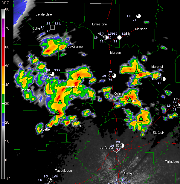
Showers and thunderstorms have blossomed this evening across North Central Alabama.
They are heaviest in two main concentrations…
…over much of Winston and northwestern Walker Counties down into NE Fayette County.
…Over much of Blount County, extending up to along the Cullman/Blount County line.
Lightning is intense over much of Winston County, especially west and southwest of Double Springs…down to around Carbon Hill.
Lots of lightning clustered around Hanceville and from Oneonta to west of Springville in Blount County. Tops of the storms around Blountsville are pushing 50-55k feet with some 45-50k foot tops over Blount County.



