


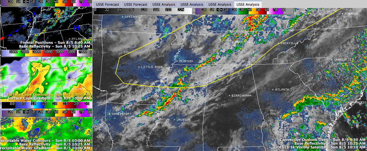
Showers and storms were increasing in coverage and intensity this morning from northern Mississippi into Tennessee. They are just northwest of the very northwest corner of Alabama. They are forming in a convergence zone ahead of a cold front that stretches from southwest to northeast from near Dallas to Little Rock to Indianapolis.
Clouds are pretty thick northwest of a line from Hamilton to Athens across Northwest Alabama. South of there, skies are partly cloudy, with increasing sunshine the further south you go.
A peek at the Birmingham morning balloon release indicates a pretty moist airmass well up into the atmosphere. Preciptable water values are about 25% higher than yesterday. When temperatures reach the lower 90s as forecast for this afternoon, instability levels will be moderately high, around 2,500 j/kg. Scattered storms should develop across the rest of Central Alabama as soon as temperatures reach the middle 80s or so. There is very little shear, so the storms will be typical summeritme pulse storms that go up quickly and rain themselves out.
Storms will be more common and stronger over Northwest sections. The SPC has a slight risk severe weather outlook, their standard forecast for elevated chances of organized severe weather this afternoon and overnight north of a line from Hamilton to Decatur to Scottsboro. This is because of the proximity to the front.
TROPICS
No new big news on Ernesto and Florence. Ernesto is poorly organized and moving westward at a rapid clip. Top winds are 50 mph. The pressure was back down a bit, to 1006 mb. The system looks poorly organized on satellite imagery. It seems to be running into dry air and the fast forward motion can take a toll on a tropical system as well. Still expecting Ernesto to cross the Yucatan on Wednesday, move over the southwestern Gulf and make landfall in southern Mexico on Friday. Florence has stopped strengthening over the eastern Atlantic. Florence is expected to weaken over the next few days as it moves west northwestward to a point north of the islands on Thursday. It will probably dissipate after that.



