


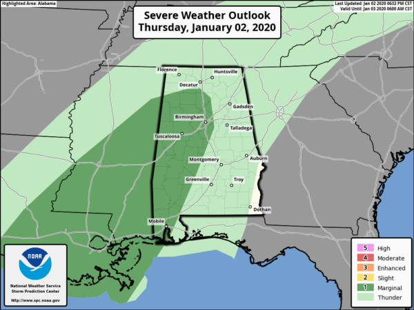
The Slight Risk for severe storms (level 2 of 5) has been removed from Central Alabama. A Marginal Risk (level 1 of 5) remains in effect for locations south and west of a line from Hackleburg (Marion Co.) to Falkville (Morgan Co.) to Columbiana (Shelby Co.) to West Selmont (Dallas Co.). The rest of North/Central Alabama is not in a threat for severe storms.
A marginal wind damage threat may continue this evening into tonight across parts of North/Central Alabama.
A line of thunderstorms is ongoing in a plume of mid-level moisture from southern Louisiana into central Mississippi. Surface dewpoints to the east of the convective line are near 70 F which should result in enough instability to maintain the line this evening and possibly into the overnight period. As the line moves slowly eastward and interacts with the western edge of a 40 to 50 kt low-level jet, there should be enough shear for an isolated wind damage threat. The potential for strong wind gusts may impact southern Mississippi and western Alabama later tonight. But instability will remain very weak and the convection should remain mostly on the cool side of the boundary, suggesting that any threat that persists will be marginal.
Information is taken from the Storm Prediction Center.



