…Major travel problems developing already…see Bill’s post below…
…Lots of snow pictures from around Alabana…see James Spann’s post below…
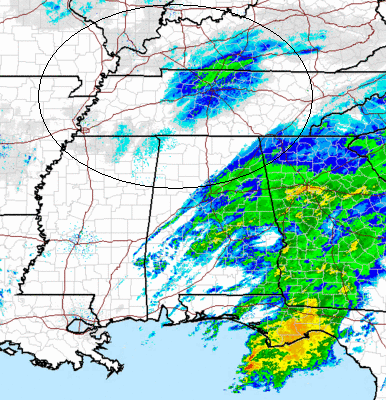
The main area of snow is moving east of BHM now. Unofficially, the BHM airport had about 1″ of snow…it won’t be official until 6 pm CST. The actual liquid equivalent of the snow was 0.16″ so far…meaning about 1.6″, but since surface temps have been above freezing, the snow has been melting. We’ll have to see how the observer at the airport reports this.
Now that the beautiful White Christmas snow “falling” is coming to an end, we have two other weather issues to deal with for the next 24-36 hours. First of all, as it gets dark and we have northerly winds, temperatures will fall below freezing (they have already in some higher elevations), and with all the melted snow, bridges will ice tonight. I would advise everyone to be wherever they plan to stay tonighy by sunset (430 pm) or earlier.
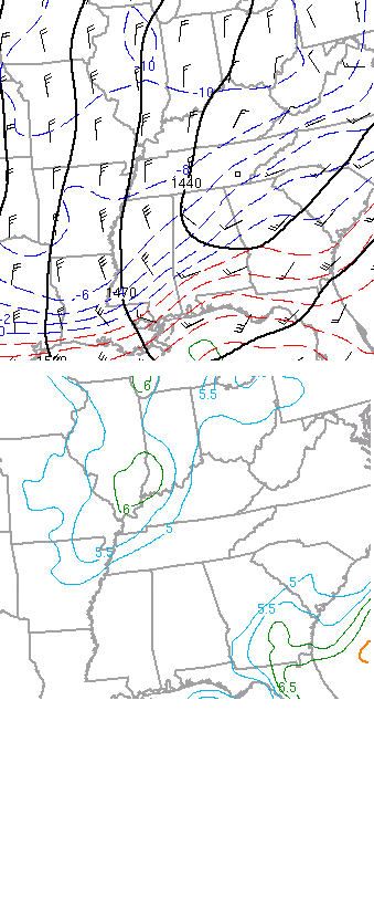
Secondly, with the very cold air coming in aloft (at 5,000 ft., or 850 mb, see below), creating large low-level changes in temperature with height (6 degrees C/km, or about 3 degrees F per 1,000 ft.), the air will get unstable this evening, similar to summer, and scattered snow patches will develop again tonight. Some people may see nothing, others may see another 1/2″.
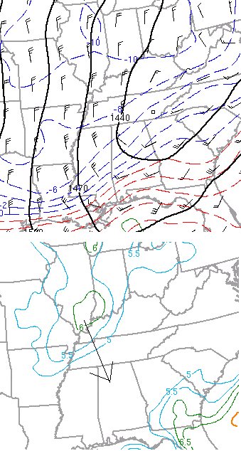
850 mb temps and low-level lapse rates approaching.
Either way, travel will be dangerous this evening and into tomorrow morning, and you may see a little bit more snow (10 or 15 minutes of heavy snow and then over), this evening.