


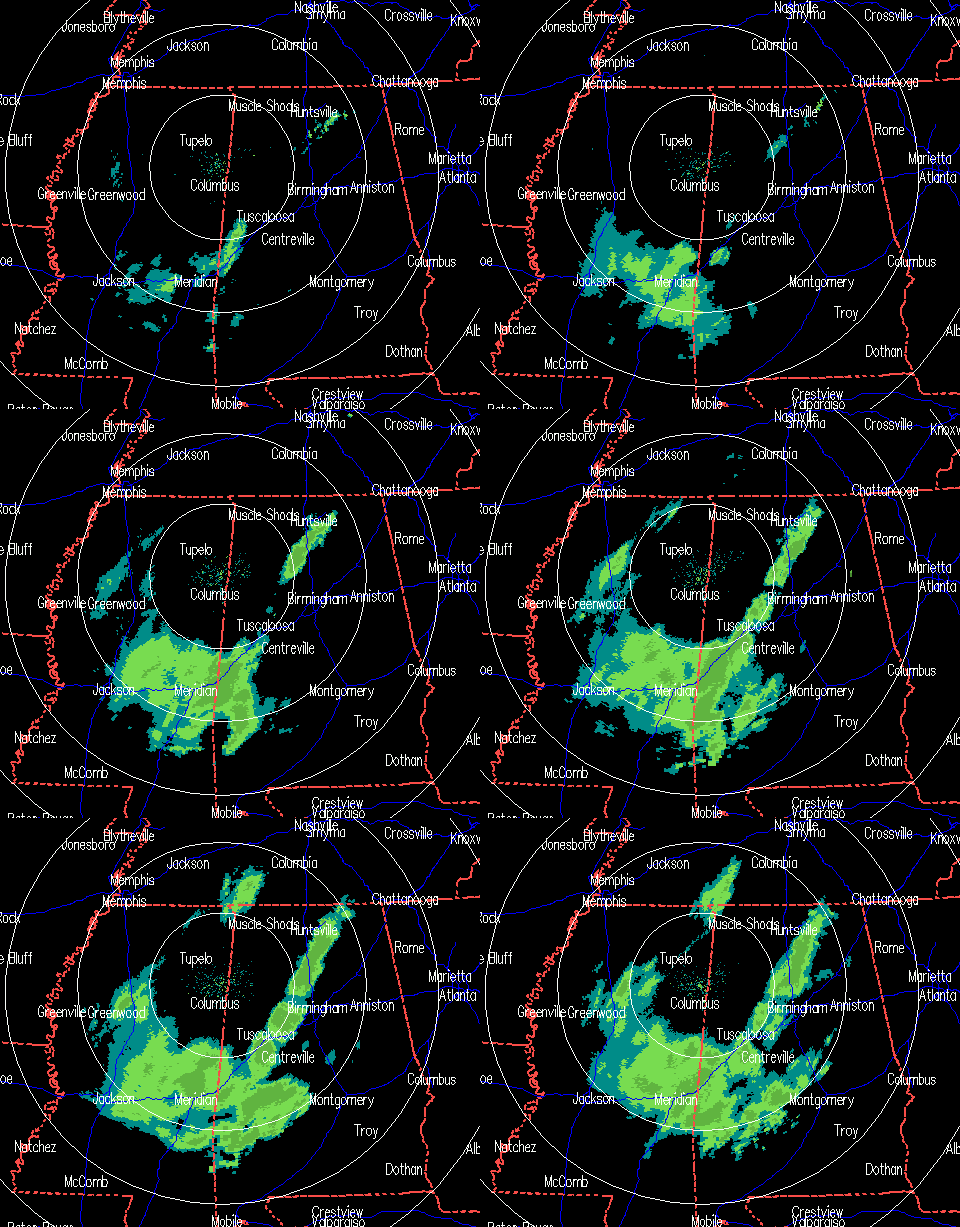
Radar continues to show precipitation increasing over Alabama, and most of it is likely snow or sleet once it has been falling for more than 30 minutes or so. However, as Brian pointed out earlier, there is a layer of dry air at low levels, so it has to snow a while above your location, where the radar is looking, before the atmosphere can saturate and the precipitation (rain, then sleet and snow) can reach the ground. Here is the balloon data from the NWS at Calera from 5 pm. The red line is the temperature and the green line is the dewpoint.
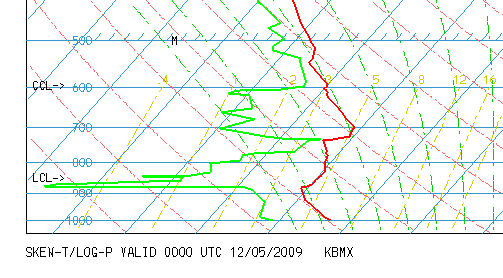
Notice the large separation between the temp and dewpoint below 850 mb…that indicates low relative humidity. However, it still looks like there is enough moisture and vertical motion coming in from the west to support 1/2″ of snow in many parts of central and south Alabama, with some locations getting 1″ or more.
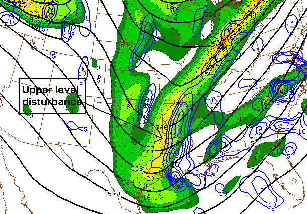
500 mb heights, vorticity
The main upper-level disturbance is still in Arkansas and Louisiana, and the heaviest precipitation is usually ahead of that.
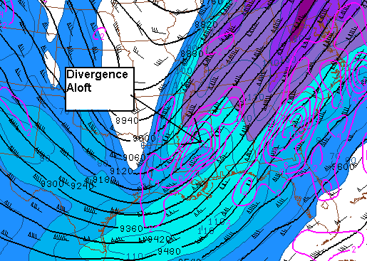
300 mb height, winds, divergence
There is also divergence aloft over Mississippi that will spread into Alabama. This is important because as air diverges aloft, more air must rise from below to fill in the gap, helping produce vertical motion and precipitation. Light snow should begin to fall in parts of the BHM metro area by 11 pm.
The snow is causing travel problems to our SW, but we don’t expect anything major here. If you have to drive in the morning, watch for ice, mainly on bridges and overpasses, and in higher elevations. Use common sense. Leave plenty of room between you and other cars, and slow down.



