


Most of the 12 UTC models are now in. Still some disagreement, making the forecast more difficult. Model snow amounts for BHM and MGM:
Model/BHM/MGM
NAM: 1″/1.7″
GFS: 0.1″/0.5″
Canadian: 1″/1.5″
SREF: 0.5″/1.0″
This is the “classic” setup for snow in Alabama, with an upper level disturbance moving across central Alabama and a low pressure area in the Gulf. It’s a weak system, so snow amounts are small. The GFS model is the outlier, showing a layer of dry air at low-levels and weaker dynamics, resulting in only flurries. This model has been inconsistent the past few days, going from 5″ to 0 to 2″ to 0, so I would lean a little more on the NAM, since it has been more consistent.
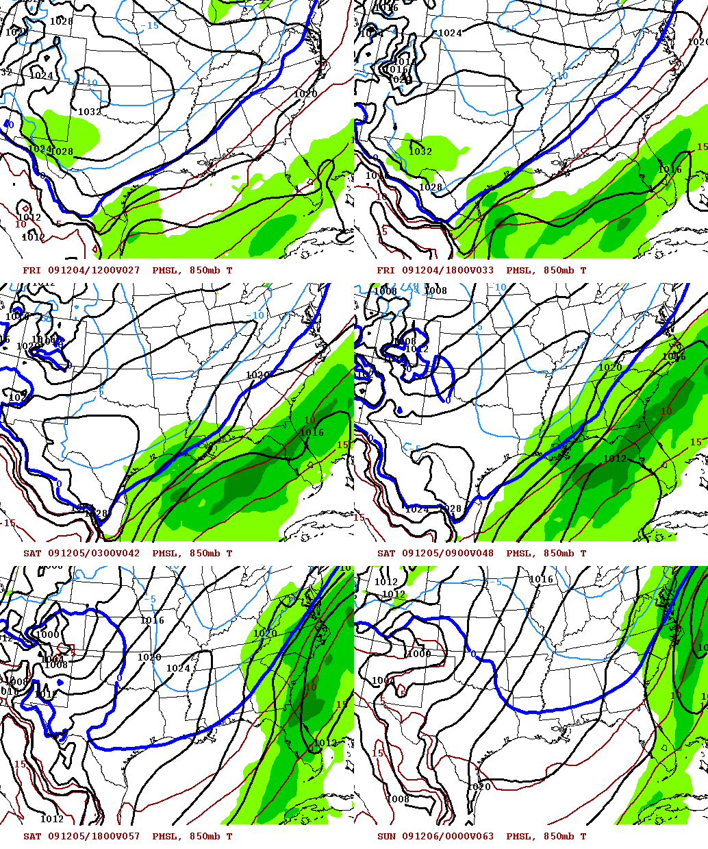
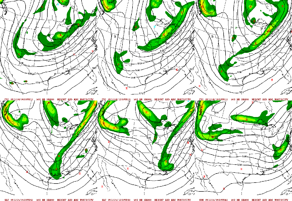
Here are loops of the NAM surface pressure field, precip, and 850 mb temp (when 850 mb temps are below freezing, precip generally falls as snow), and of 500 mb heights and vorticity, showing the upper-level disturbance. These loops run through Saturday at 6 pm.
Here is the total precip accumulation for the event, from the SREF model. The amounts I show are for snow, but the rain/snow line will likely be somewhere between Clanton and Montgomery.
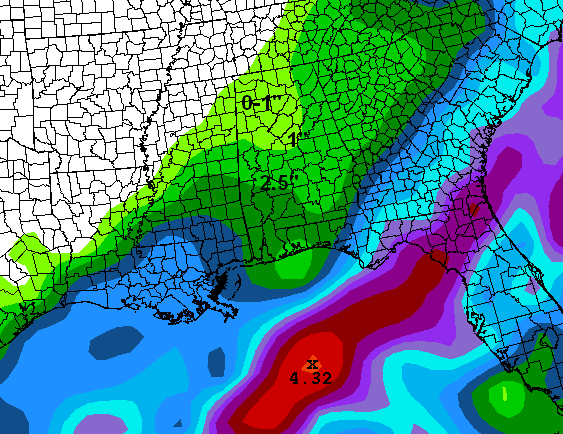
So, unless the GFS model is keying on something the other models are not, we could see 1/2 to 1″ of snow in BHM Friday night/Saturday morning, and somebody in south-central Alabama may see up to 2″. I put the favored location in Montgomery yesterday, I’m going with Thorsby now.
One other thing to mention is that the ground is warm. Here are 4″ soil temperatures from some stations of the Auburn Mesonet from 7 am this morning:
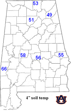
So, any snow that falls will have a hard time accumulating, and travel problems should be limited. Still, there could be some icy bridges Saturday morning if this event actually happens. The good thing is that with warm ground temps and highs reaching the upper 30s Saturday afternoon, most of the snow should be gone by sunset Saturday anyway.
It will be fun to watch this one!
For your meteorological consulting needs, Coleman and Peters, LLC, can provide you with accurate, detailed information on past storms, lightning, flooding, and wind damage. Whether it is an insurance claim needing validation or a court case where weather was a factor, we can furnish you with information you need. Please call us at (205) 568-4401. Also, a close friend of mine has formed a new law firm, The Hooks Law Firm, here in Birmingham. You can call him at (205) 470-3063.



