


We have been monitoring a trough of low pressure over the western Caribbean extending northeastward across Cuba into the Bahamas.
This trough is moving northwestward slowly and will be over the Gulf of Mexico. The GFS has been hinting for several days that we could see some type of tropical development over the southwestern or southern Gulf by the weekend.
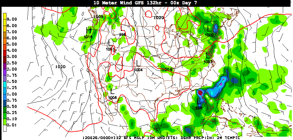
It is much more bullish on that idea this morning with the 12z run. Here is its forecast for 132 hours out, which is Monday night, showing the storm approaching the West Coast of Florida north of Tampa, likely as a tropical storm.
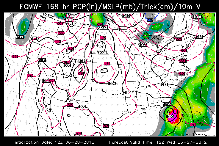
The European model is in fair agreement with that idea. Here is its depiction of the storm approaching the same area early Wednesday, perhaps as a strong tropical storm or weak hurricane.
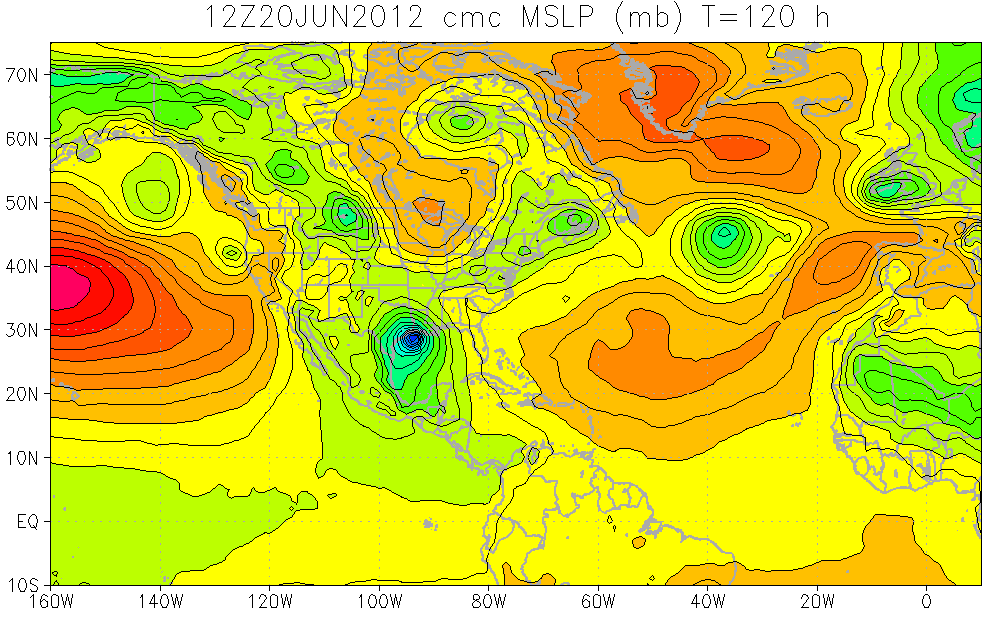
But not so fast my friend. Steering currents will be weak over the Gulf, and here comes the Canadian with the idea of a definite westerly track, counting on the ridge to the northeast of the storm being stronger. This would be a category one or two hurricane approaching Lake Charles/Houston early on Monday morning.
So, it will be model madness over the next several days as we try to pin this system down. Will it develop? Will it move west or east? How much will it intensify? For now, we don’t think it will impact Alabama’s weather or weather along the Gulf Coast, but stay tuned!
SIDE NOTE
June 27th is the 55th anniversary of Hurricane Audrey, which rapidly strengthened in the hours before landfall on the Southwest Louisiana coast, going from category two to category four in a short period. The storm surprised many who thought they could evacuate the following morning, but rapidly rising tides during the night cut off their escape routes. 390 died. 190 were never found.


