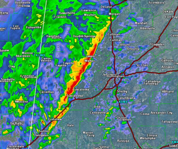
A line of intense storms is impacting locations from Tuscaloosa to Jasper up to Cullman. The storms remain below severe limits, but they are producing gusty winds and very heavy rainfall. The winds are gusting 35-45 mph.
This line is sliding to the east as the individual storms within the line race off towards the northeast. This line of storms will be arriving into the downtown Birmingham around 2 AM.
Once the line passes, the NWS is removing counties from the tornado watch that remains valid until 2 AM.