


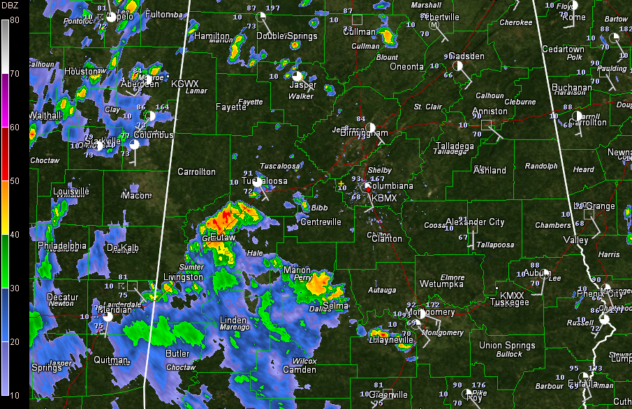
Showers and storms are scattered across mainly North and West Alabama this afternoon.
The heaviest storms are over Greene and Hale Counties, from near Eutaw to Moundville. They are producing lots of lightning and impressive rainfall amounts.
Other storms are producing brief heavy rain, lightning and gusty winds.
Elsewhere, it is a typically hot and humid summer day across Central Alabama. It was back up to 85F at the Birmingham Airport after a shower briefly cooled it to 81F. 0.28 inches of rain fell at the Airport. Tusacaloosa had gotten to 91F before a shower moved over the airport in the past few minutes. Showers are growing to the south of Coaling and Vance and will cross I-59 as they strive to grow into storms.
Everything is moving north northwest.
Anniston was at 90F.



