


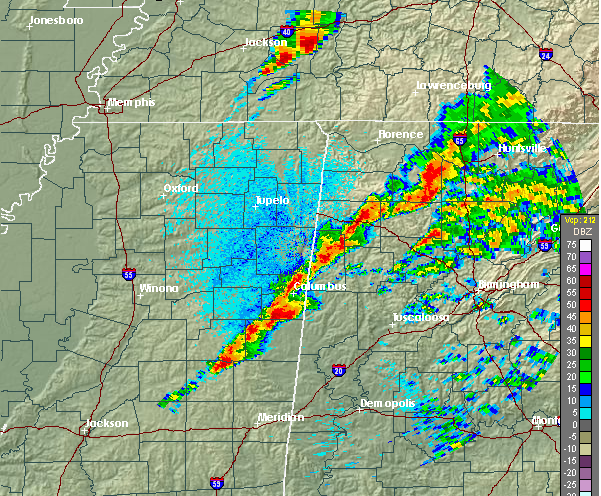
Fortunately, the large storm that produced a tornado in cdentral MS has weakened as it moved into the more stable air over Alabama. The warm air has produced scattered showers and thunderstorms over much of central Alabama, holding temperatures down so far. That is good news, and so far the instability has been limited, preventing a major tornado outbreak in Alabama like has occurred in MS. The 850 mb jet is starting to lift out a little bit to the north, and that will help reduce the wind shear somewhat over north Alabama during the next 4 hours. However, wind shear is still very strong.
The storms have now formed a line of supercells, extending from Huntsville to Columbus, MS. There is plenty of instability and wind shear to hold these storms together. Hopefully the atmosphere won’t have time to become as unstable as it did in MS, but we do expect dewpoints near 70 to move as far north as BHM this evening. Even though the shear is decreasing, it is still plenty strong for tornadoes in the line of storms, so keep a source of weather information nearby this evening, because everyone in central Alabama will eventually deal with this system, and expect tornado warnings to come out and sirens to go off around the state. Please have a tornado plan wherever you are, and act quickly if there is a tornado warning. Right now, the main danger is in west-central Alabama, west of a line from Carbon Hill to Demopolis, and it will eventually make it to TCL and BHM.
Bottom line…it doesn’t look quite as bad here as did it in MS, and it helps that it rained and kept it a little cooler, but we are decreasing from almost unheard-of parameters to strong parameters, and a few tornadoes, in addition to widespread wind damage, are likely across Alabama between now and 11 pm or even later.



