


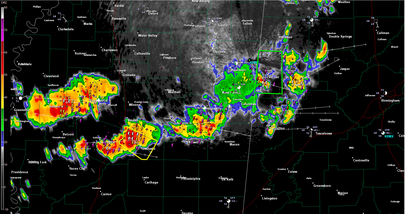
New severe thunderstorm warning just issued for Attala County MS, including Kosciusko, This storm is moving ESE at 30-35 mph. This storm will reach Sumter and Greene Counties in less than three hours, if it holds together. It looks like it might hold together as it rides a boundary of instability that extends east southeast into West Central Alabama.
A couple of reports of wind damage and some large hail reports out of Mississippi, including a ping pong ball size report from between Winona and Kilmichael.
Other storms between Greenville and Greenwood will follow these storms. perhaps on a slightly more northerly tack. This could get them into Pickens and perhaps Tuscaloosa Counties. All of this activity will push into Central Alabama overnight.
The main activity should be south of US-82, but there are storms over Lamar, Fayette, southern Marion, Pickens and northwestern Walker Counties at this time. They are accompanied by lots of lightning and strong gusty winds. These storms are pushing east generally and will affect areas from Cullman to the Birmingham Metro. They should weaken slowly with time and stay well below severe limits. They will probably produce lightning all the way into Northeast Alabama in the hours after midnight.
A couple of the storms will possibly be severe over West Central Alabama, again, mainly south of US-82, so expect a warning or two. The probability of a tornado in Alabama is almost zero.
A flash flood warning continues for Lamar County until midnight. Some moderate rain is pushing across the southern half ofthe county at this time. No reports of flooding this evening, but there could be some flooding in low lying and poor drainage areas. More heavy rainfall will be likely from the bigger storms.
More showers will develop during the morning over North and Central Alabama ahead of the cold front, but they should not be heavy.



