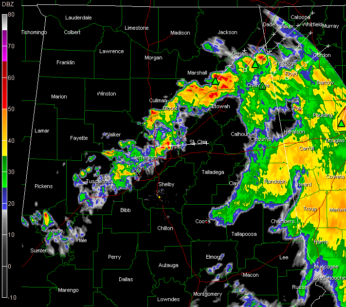
Showers and thunderstorms from the Birmingham Metro area southwestward have really weakened in the past 30 minutes as they move eastward into more stable air that was cleared out by the earlier convection that is pushing into Georgia.
The severe thunderstorm warning for Blount County expired at 5:15.
The Cherokee County warning did as well.
The strongest storms are from southwestern DeKalb County back through southern Marshall and Etowah Counties from near Douglas to Boaz to Crossville.
They’re moving northeast like all of the other storms.
There are some pretty heavy storms between Gardendale and Trussville as well, but they are not anywhere close to severe.
The severe thunderstorm watch will be allowed to expire at 6 p.m. according to the National Weather Service.
The storms should continue their weakening trend over the next couple of hours and be pretty much gone by mid-evening.
Drier air will start to filter in overnight and dewpoints will be in the upper 50s by morning.
LATE REPORTS
…Just before 4 p.m., trees and power lines were reported down across much of Roanoke.
…Trees reported down on trailer and car 4 miles SW of Auburn at 3:20 p.m.
…Just before 4 p.m.,