


All modes of severe weather, including tornadoes are possible across much of Alabama today. It will be the kind of day where everyone in Central Alabama will want to pay attention to the latest watches and warnings and be ready to take action if damaging winds, hail, flooding or a tornado develops in their area.
STORMY FEEL
Winds are roaring across Central Alabama early on this Sunday morning, averaging some 15-20 mph out of the south, with gusts to nearly 30 mph. Consequently, a wind advisory is in affect across the area today.
It is muggy, with temperatures in the middle and upper 70s and dewpoints in the upper 60s to lower 70s at 5 a.m. in the morning.
The result is that it feels like storms, or tornado weather. So what is the threat for today across Alabama?
The SPC has outlooked most of Alabama for a slight risk of severe weather for today.
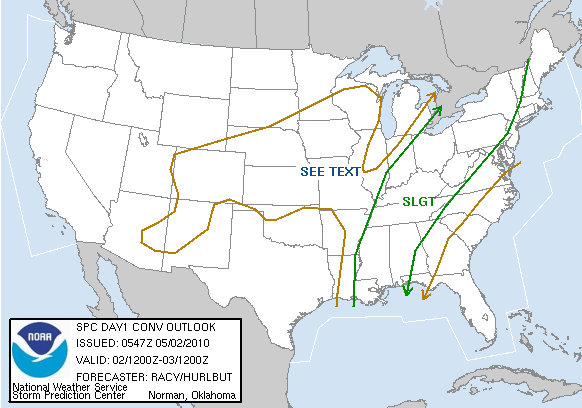
There is a fairly big threat of damaging winds over areas near and north of I-59 today. The SPC puts that probability at around 30% of having a 58 mph wind gust within 25 miles of points in the threat area.
The entire Slight Risk area has a 15% probability of severe hail (1 inch or greater) within 25 miles of points in the 15% hail area.
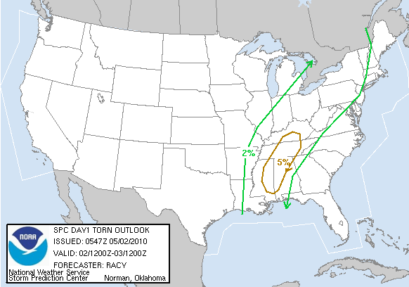
According to the SPC, there is a 5% probability of tornadoes within 25 miles of points in the 5% tornado threat area.
In addition to all of this, 3-4 inches of rain is expected across much of Central Alabama today.
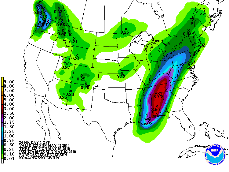
Flash flood watches continue for Central Alabama.
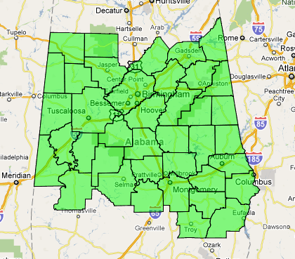
From 1 p.m. Sunday through 1 p.m. Monday: Fayette, Greene, Lamar, Marion, Pickens, Sumter, Tuscaloosa, Walker and Winston.
From 7 p.m. Sunday through 7 p.m. Monday…Autauga, Barbour, Bibb, Blount, Bullock, Calhoun, Chambers, Cherokee, Chilton, Clay, Cleburne, Coosa, Dallas, Elmore, Etowah, Hale, Jefferson, Lee, Lowndes, Macon, Marengo, Montgomery, Perry, Pike, Randolph, Russell, Shelby, St. Clair, Talladega, Tallapoosa
SO BOTTOM LINE…
The trough is beginning to push slowly east and will bring widespread thunderstorms to the area today. Thunderstorms will slowly intensify through the morning hours back over Mississippi and gradually push into Alabama during the morning.
Storms will become widespread later this morning into Alabama, Damaging winds will be a significant threat. There will also be a threat of tornadoes and hail. Flooding will become a problem as heavy rain falls from training cells. Hopefully the system will push east a little faster than earlier thought and reduce the heavy rain threat.
Stay close to a reliable source of weather warnings through the day and into the overnight.



