


**No Weather Xtreme video due to ongoing weather issues**
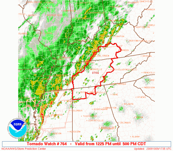
Below is the latest tornado watch that includes the Tennessee Valley of North Alabama…
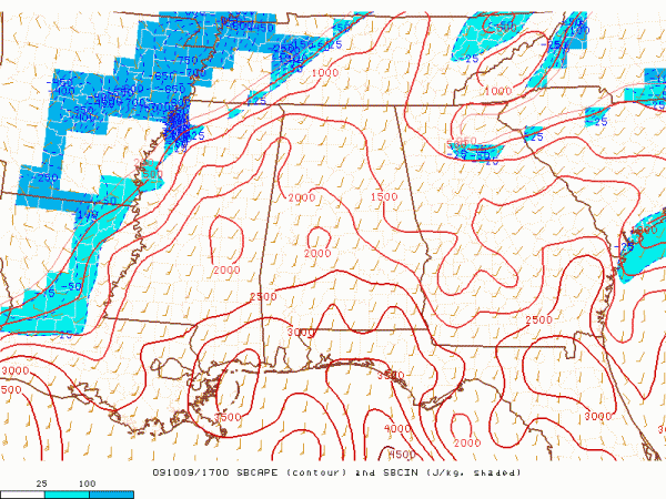
Concerning instability, the surface based CAPE values are below (from SPC)…
And, below is the current 0 to 3 km storm relative helicity (veering of the wind with altitude)…
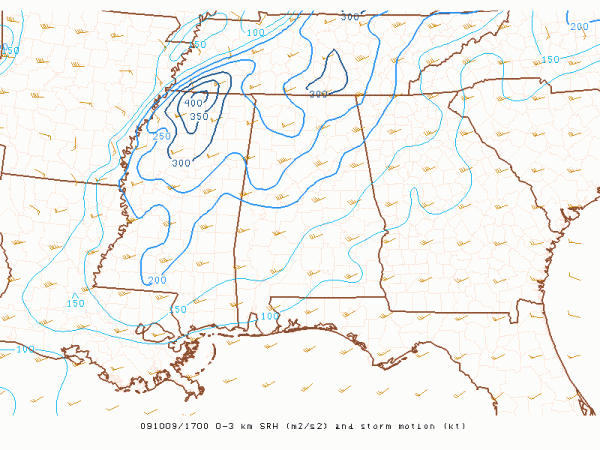
You can see the shear values are peaking now over the Tennessee/Mississippi border, but are sufficient enough over extreme North Alabama for some potential for isolated tornadoes.
The prime severe weather risk for Alabama will come north of I-59 (Livingston to Tuscaloosa to Birmingham to Gadsden to Fort Payne), between 2:00 and 8:00 p.m. The main threat will come from damaging straight line winds, but an isolated tornado is not out of the question. The severe weather risk will fade after 8:00 as the air becomes more stable, but periods of rain will continue into the day tomorrow.
The NAM is printing 2.03″ of rain for Birmingham during the next 84 hours; most places can expect 1 to 2 inches of rain between now and tomorrow afternoon, with isolated pockets getting more. Some flash flooding is not out of the question, and the NWS in Huntsville continues a flash flood watch for their counties up in the Tennessee Valley.
SUNDAY AND BEYOND: Still looks like the best chance of rain Sunday will be over the southern half of the state, but rain will increase statewide again Monday and Tuesday. Very hard to get multiple dry days in this kind of pattern.
WARMTH: Birmingham is reporting 85 degrees at 12:00 noon…. not far from today’s record high of 91 set in 1941. Tomorrow we will struggle to get out of the 60s with clouds and rain.
We will keep the blog updated with fresh information through this event, so stay tuned…



