


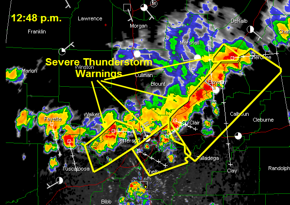
A mesoscale convective complex is moving southeastward across Central Alabama this afternoon.
Severe thunderstorm warnings are in effect all along the line from northern Tuscaloosa and western Jefferson Counties into Shelby, St. Clair, Talladega, Etowah, Cherokee and Calhoun Counties.
New severe thunderstorm warning just issued for Tuscaloosa County til 1:30 p.m.
Quarter sized hail was reported in Morris at 12:20 p.m.
JB Elliott reported winds estimated at 50 mph just northeast of Trussville at 12:35. He reports the winds have diminished now. He still has very heavy rain and severe lightning. Thunder is roaring here at my location in Trussville.
Michele Miklik in Weaver reported that sirens did sound earlier, even though no tornado warning is in effect. She did report seeing mammatus clouds, which are caused by descending pounces of air under the anvil of a storm.



