


Daily Weather Briefing
Saturday, March 7, 2026
ALABAMA THIS MORNING
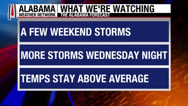
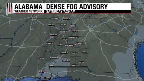
Clouds envelope most of the state this morning, while fog covers the south. The area will be in a Dense Fog Advisory until 9 a.m. Warm temperatures greet Alabamians as they wake, sitting in the 60s east, mid 60s in the central third of the state, and the upper 60s to around 70 degrees south. The clouds and warm temperatures are indicative of moisture and fuel that storms will feed on later today.
ALABAMA 7 DAY FORECAST
A cold front will enter the northwestern corner of the state this afternoon, bringing a line of showers and thunderstorms with it. There is a low chance of severe weather. Thunderstorms continue into tomorrow, but without a severe threat. Scattered showers and thunderstorms linger through Tuesday, then another cold front brings another line of thunderstorms to the state Wednesday and Thursday. A shower or two may happen Friday. Warm highs will trend through Wednesday, then will be on the cooler side Thursday and mild Friday, especially compared to the warmth we’ve seen recently.
STORMY SATURDAY AFTERNOON
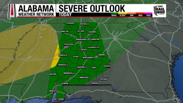
Cloudy conditions with a few breaks for clouds will pre-curse this afternoon’s stormy weather. Anywhere from 2-4 p.m. today, a cold front will enter the state and move slowly from northwest to southeast through the evening into tomorrow morning. The entire state, except for the southeastern corner, is under a Marginal Risk (1/5) of Severe Thunderstorms today. The main threats with this system include damaging straight-line winds, hail, lightning, and heavy rain. Tornado chances are very low, but you should always expect the unexpected. Southeastern Alabama will still see a few storms, but they should stay sub-severe. Make sure you have multiple ways to receive severe weather alerts and stay tuned with the Alabama Weather Network, as we will go live if severe weather occurs.
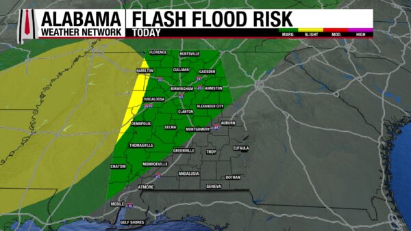
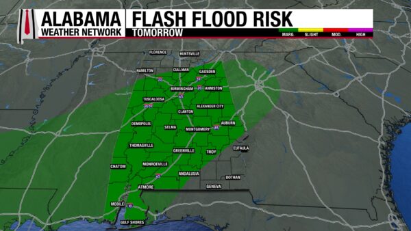
Along with the severe weather threat, there is a Marginal to Slight Risk (1-2/4) for Excessive Rainfall stretching to most of the southwest and the eastern portion of south-central Alabama. The system is relatively slow-moving, and its moisture content is high. Flash flooding is possible, so make sure to turn around and not drown!
Highs will reach the upper 70s to low 80s north, low 80s centrally, and low to mid 80s south.
STORMS CONTINUE OVERNIGHT
As we head into the night, the line of storms will traverse slowly southeastward. The severe threat will continue, but storms will weaken toward the early morning hours as fuel, such as daytime instability, will no longer be available. Lows will fall only to the upper 50s to mid 60s from north to south.
STORMY SOUTH ON SUNDAY
The cold front will attempt to reach the south but will stall in central Alabama. This will keep the nature of the thunderstorms isolated and scattered in north and central Alabama tomorrow. Thunderstorms will be more widespread south, but severe weather ingredients will be much less available Sunday compared to today, leading to most storms staying sub-severe. Heavy rain, lightning, and occasionally strong winds will be the main threats with these storms. There is a Marginal Risk for Excessive Rainfall everywhere but in the north and southeast. Flash flooding is possible. Highs will sit in the low to mid 70s statewide.
SCATTERED SHOWERS MONDAY AND TUESDAY
As the transition from one frontal system to another occurs, Monday and Tuesday will have a low chance of scattered showers and thunderstorms. Highs on Monday will bounce back into the upper 70s in the northern half of the state to the low 80s in the southern half. An increase into the low 80s north and mid 80s south occurs Tuesday.
ANOTHER COLD FRONT BRINGS MORE STORMS WEDNESDAY AND THURSDAY
Another cold front will begin to move through the state Wednesday, bringing a chance of severe weather, especially to the north. It is still early to know the timing and severity of the weather, but just keep the possibility on your radar (no pun intended). Highs will span from the low to mid 80s. The front will move further south Thursday, bringing thunderstorms south as well. Highs Thursday will only hit the mid 60s north, low 70s centrally, and upper 60s and low 70s south as the cold front brings a cooler airmass to the state.
SHOWERS POSSIBLE FRIDAY
A few showers are possible on Friday. Highs will range from the upper 60s north to the lower 80s south.
RAINFALL OUTLOOK
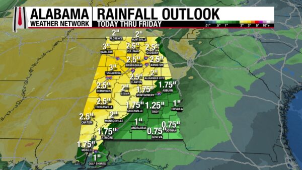
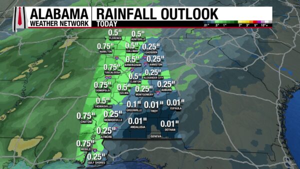
The state will receive much-needed rain over the next 7 days, and today will contribute to much of that. Anywhere from 0.1″ to 0.75″ of rain could fall today.
WORSENED DROUGHT, SOME RELIEF SOON
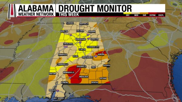
After a pretty dry week, drought conditions have worsened since last week. There is no longer any portion of the state that has not experienced some sort of dry/drought conditions. Additionally, 53.85% of the state is under a Moderate Drought (D1). This upcoming rainy pattern should help some conditions improve.
BUMPY WATERS
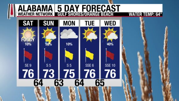
The rip current risk is high today ahead of the storms, and the surf is dangerous for all levels of swimmers. It will be better to stay on land today, and luckily, conditions will not be too shabby for that. The high will be in the mid 70s, and winds will be around 10 mph. The sky will be overcast, so tanning is out of the picture. Tomorrow will be a stormy day on the coast.
TODAY IN WEATHER HISTORY
March 7, 1962 – The Ash Wednesday Storm
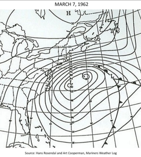
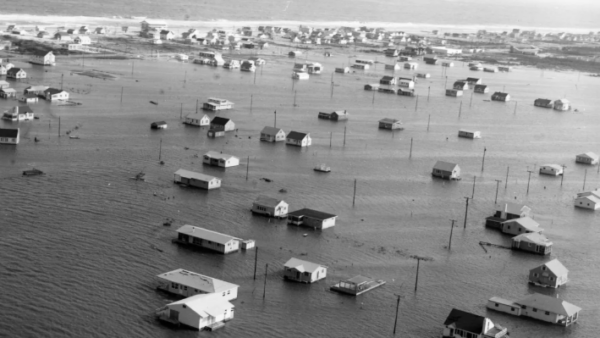
In 1962, Ash Wednesday fell on March 7th. It is the High Holy Day Signifying the beginning of the Lenten period. That day, an unusual series of factors was coming together to create an especially bad situation along the U.S. East Coast. First, there was a new moon, which meant spring tides along the coast that “sprung” higher than they normally would. In addition, twice every 29.5 days, the Earth is aligned with the sun and the moon, and the gravitational pull on the tides is greater, making the tidal range higher. This is called syzygy. At syzygy, high tides are higher than they normally would be. The third factor was that the moon was at perigee. The moon’s orbit around the Earth is not perfectly circular. It is shaped more like an oval. The Earth is located closer to one end than the other, meaning that once during each orbit, the moon is much closer to Earth than at other times. Nearly 225,000 miles closer, in fact. When the Earth and moon are at their closest point, it is called perigee. The two events usually occur within 36 hours of each other a few times a year. This time, though, they were 30 minutes apart from one another. By themselves, these two events would not cause very much trouble, but they occurred simultaneously with a huge late-season nor’easter, known as the Great Atlantic Storm to meteorologists. Locals christened it the Ash Wednesday Storm, as the storm developed into one of the worst Nor’easters the Northeast has seen in history. The coast was torn apart by the inundating ocean waters, while areas further inland experienced blizzard conditions. Sea Isle, New Jersey, ended up under 5 feet of water, and Atlantic City saw waves as high as 25 feet. Dunes eroded, and quickly, new inlets were created, and piers were destroyed. Winchester, Virginia, measured 23 inches of snow, a record for the area, and 42 inches fell in the Blue Ridge mountains in the state. Snow was recorded from Alabama to New England, and the storm produced winds of 60 mph. To add to the uniqueness of the storm, the Nor’easter sat over the region for three days, its forward progress blocked by high pressure to the north. A typical Nor’easter lasts only one day. When it was over, 1800 structures were destroyed, damages totaled $500 million, and forty people died.

IMAGE(S) OF THE DAY
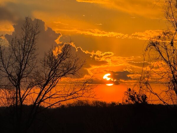
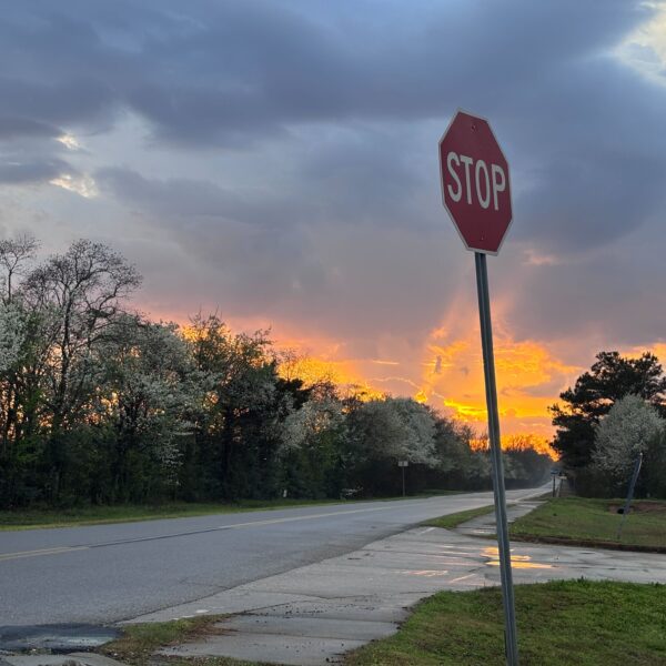
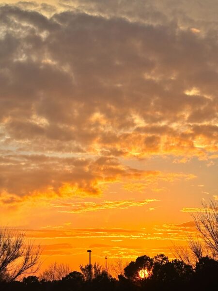
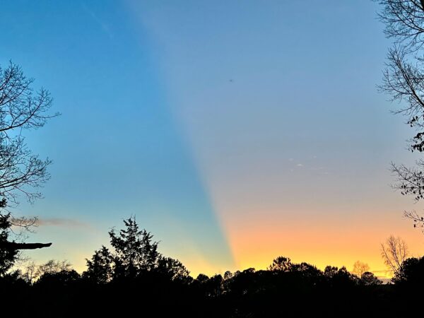
Multiple gorgeous sunset photos were sent in yesterday.
1. Mark Sparks – Clay
2. Ty Burton – Wetumpka
3. Ivy Hale – Cullman
4 & 5. Tyne Wingo – Corner



