ALABAMA THIS MORNING
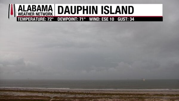
Early Sunday brought a mix of clear skies in the north and cloudy, breezy conditions across central and southern Alabama. Radar showed showers and a few thunderstorms along the coast from Gulf Shores to Mobile, while the rest of the state remained dry. Temperatures at 7 AM ranged from the lower 60s in the north to the lower 70s near the coast. A few of those coastal showers could drift inland later today, but most areas will stay mainly dry with highs climbing into the 80s.
SPANN SKYWATCHERS
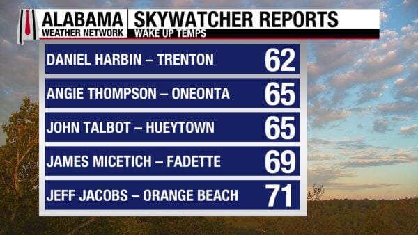
Sunday began mild and mostly cloudy across Alabama, with a few spots along the coast picking up light rain early. Jeff Jacobs in Orange Beach measured 0.12 inch of rainfall as of 6:30 AM.
DANCING WITH THE STATS
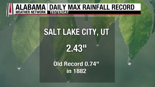
SALT LAKE CITY SOAKS IN RECORD RAIN
A soaking storm drenched northern Utah on Saturday, with Salt Lake City picking up 2.43 inches of rain — shattering the old daily record of 0.74 inches set in 1882. It marked the city’s wettest October day on record and the second-highest daily rainfall total in its history, trailing only the 2.64 inches from May 3, 1901. The two-day total reached 2.57 inches, ranking as the fifth highest two-day rainfall on record for the city.
NATIONAL OUTLOOK
HEAVY RAIN AND MOUNTAIN SNOW IN THE WEST
A strong upper-level storm continues to move through the north-central U.S., spreading mountain snow across western and northern Wyoming into western Montana where totals of 6 to 12 inches are likely, with higher amounts in the tallest peaks. Behind the front, temperatures drop sharply—20 to 30 degrees cooler than recent highs—with freeze watches and warnings in place across much of Wyoming and nearby areas.
SEVERE STORMS AND HEAVY RAIN TARGET CENTRAL PLAINS
A cold front sweeping through the Plains will spark isolated severe thunderstorms late this afternoon and evening, mainly across Kansas where hail and gusty winds are the main threats. The same front will produce a narrow corridor of heavy rainfall from central Kansas into southeast Nebraska and Iowa, where localized totals could reach 2 to 3 inches and hourly rates near 1 to 1.5 inches may trigger isolated flash flooding, especially in urban areas.
GULF COAST SOAKED; HEAVY RAIN FOR FLORIDA
A deep tropical airmass and coastal trough will keep the Gulf Coast unsettled, with widespread thunderstorms from south-central Louisiana to southern Alabama. The heaviest rainfall—2 to 4 inches with isolated 5+ inch amounts—could lead to flash flooding in metro areas such as New Orleans and Mobile. Farther east, persistent Atlantic moisture will bring scattered heavy showers to Florida’s east coast, where bands near the Space and Treasure Coasts could drop 2 to 4 inches of rain.
EASTERN WARMTH BEFORE THE FRONT ARRIVES
Warmth shifts eastward today and Monday ahead of the advancing cold front. Highs will run 10 to 20 degrees above average from the Great Lakes to the Northeast, with a few records possible before cooler air filters in midweek.
NATIONAL HIGH AND LOW TEMPERATURE
The nation’s high on Saturday was 98° at Rio Grande Village, Texas. The lowest temperature was 24° at a site 19 miles northeast of Kirk, Oregon.
ALABAMA FORECAST
SUN AND SHOWERS FOR SOUTH ALABAMA
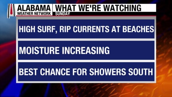
A mix of clouds and sun today across the state, with showers and a few thunderstorms developing mainly south of U.S. 80. The deepest tropical moisture is pooling near the coast, where rain could be locally heavy — 2 to 4 inches possible near Mobile and the central Gulf Coast according to the Weather Prediction Center. North and central Alabama stay mostly dry, though a few light showers could drift inland late in the day. Highs range from the upper 70s in the east to the low 80s elsewhere.
MOSTLY CLOUDY AND MILD TONIGHT
Showers linger across southern counties while the rest of the state sees mostly cloudy skies and light southeast winds. Temperatures remain mild with lows in the mid 60s north and upper 60s to lower 70s south.
MONDAY – SPOTTY SHOWERS, SEASONABLE TEMPS
Scattered showers and a storm or two continue mainly across southern and western Alabama as moisture from the Gulf persists. Most areas will see dry stretches between showers. Highs climb into the upper 70s north and low 80s central and south.
TUESDAY AND WEDNESDAY – FRONT APPROACHES, LIMITED RAIN
A weak cold front edges in from the northwest bringing 20–30% rain chances, highest across north and central Alabama. Temperatures hold in the mid to upper 80s ahead of the front. Lows stay in the 60s.
THURSDAY THROUGH SATURDAY – DRIER, SLIGHTLY COOLER
Behind the front, slightly cooler and drier air filters in with highs settling in the upper 70s to around 80 and lows in the 50s to lower 60s. A few isolated showers may linger Thursday, but much of the state trends dry heading into the weekend as drought conditions persist.
TROPICS
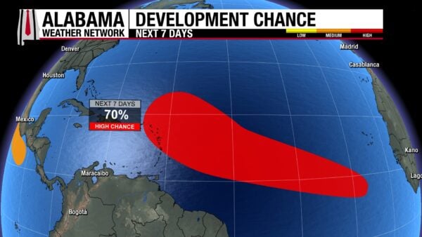
A BROAD WAVE IN THE ATLANTIC SHOWING SIGNS OF ORGANIZATION
A large area of disturbed weather several hundred miles south-southwest of the Cabo Verde Islands is gradually becoming better organized. Environmental conditions favor further development, and a tropical depression is likely to form this week as the system moves quickly westward across the central tropical Atlantic. It could approach the Leeward Islands by late week. Formation chances are 40 percent through 48 hours and 70 percent over the next seven days.
WEAK LOW IN THE GULF SHOWS LITTLE POTENTIAL
A weak area of low pressure over the north-central Gulf is producing scattered showers and storms near the coasts of Louisiana, Mississippi, and Alabama. The system will drift slowly northwest toward Texas through Monday, but strong upper-level winds should prevent any development. Formation chances remain near zero percent.
BEACH
Dangerous surf and rip current conditions continue along the Alabama and northwest Florida beaches. A High Surf Advisory remains in effect through Sunday evening with breaking waves of 4 to 6 feet, occasionally higher. The High Rip Current Risk extends through Tuesday evening, and a Small Craft Advisory is also in effect through Monday afternoon for offshore waters.
At Dauphin Island, Gulf Shores and Orange Beach, and the Pensacola area beaches, surf heights are running 5 to 7 feet with east winds around 20 mph and gusts up to 30 mph. Scattered showers and thunderstorms will persist through Monday under mostly cloudy skies. Water temperatures are in the upper 70s, and highs each afternoon will reach the lower 80s. The UV Index is low, but swimming conditions remain extremely hazardous for all experience levels.
Beachgoers should stay out of the water due to life-threatening rip currents and rough surf. Localized beach erosion and minor coastal overwash are possible. Mariners can expect seas of 6 to 9 feet and should use caution or avoid small-craft operations until winds and waves subside early in the week.
WEATHERBRAINS

Episode 1029 airs Monday, October 6, featuring Congressman Eric Sorensen of Illinois’ 17th District — the only meteorologist serving in Congress. Join us live at 7pm CT on our YouTube channel.
TODAY IN WEATHER HISTORY

October 5, 2019, marked the final day of a remarkable late-season heat wave across Alabama. Birmingham logged nine consecutive record highs, peaking at 101°F on October 2, the city’s hottest October temperature ever recorded. The run included 15 straight days above 90°F and 28 such days in September, making Alabama the nation’s hottest spot on three occasions. On top of the heat, Birmingham endured a 20-day dry spell, compounding the extremes of this historic stretch.
SKYWATCHERS PHOTO CONTEST