Daily Weather Briefing
Sunday, February 15, 2026
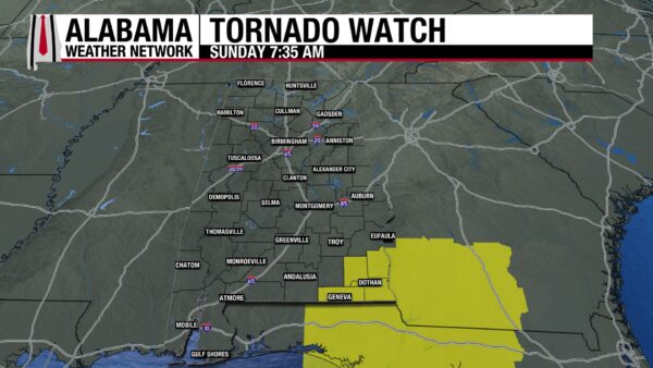
A tornado watch is in effect for Dale, Geneva, Henry, and Houston counties until 2 p.m. today.
ALABAMA THIS MORNING
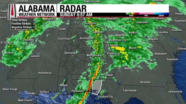
A line of showers and thunderstorms entered western Alabama around the 2 and 3 a.m. hours this morning. So far, the storms have stayed sub-severe. The line now stretches from Huntsville to Samson. Anywhere from 0.09” to 0.85” of rain has fallen since rain began last night. Temperatures sit in the upper 40s to lower 50s north to the low 60s south.
ALABAMA 7 DAY FORECAST
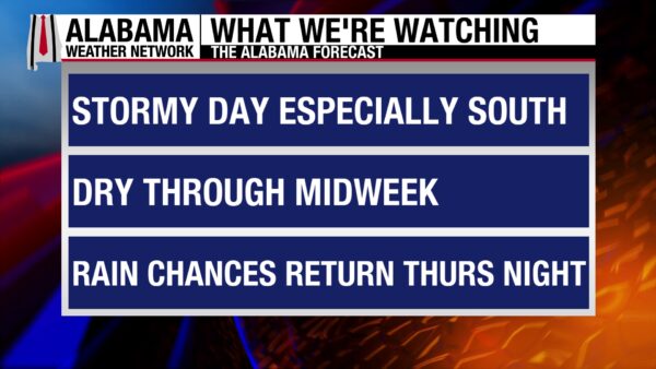
Showers and thunderstorms continue throughout the day today, with the stronger, more organized line of storms moving through the state right now. Upper-level ridging will move in tonight behind the low-pressure responsible for today’s weather and will keep us warm and dry through mid-week. Rain chances begin to increase Wednesday and stay low but present through Saturday.
STORMY SUNDAY CONTINUES
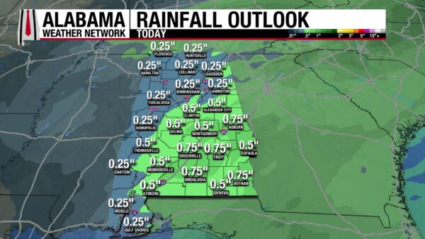
North and north central Alabama will continue to receive showers and sub-severe thunderstorms through the morning. Once the original rainmaker exits later this morning, rain will become scattered and rainfall intensity will decrease. Highs will reach the low to mid 60s. Winds will be strong at times, gusting from 20-25mph. Only around 0.25” of rain is expected to accumulate today.
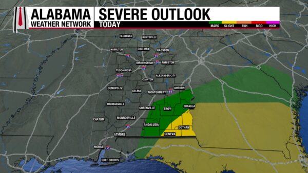
The western portion of south and south-central Alabama has already seen the main line of storms pass through the region this morning. A second round of storms is expected in the afternoon after a dry period in late morning. The most southwestern portion of the area (the coast) is under a Marginal Risk (1/5) of Severe Weather today, so damaging winds, and hail should be prepared for. We cannot rule out the chance for an isolated tornado either. Highs will climb to the upper 60s and low 70s. Winds will be gusty. Rain totals will range from 0.25” to 0.5”.
The eastern portion of the south and south-central portion of the state is either experiencing the line of storms now or will during the rest of the morning. After the line of storms passes through, another round of storms will impact the area in the afternoon. The southeast corner of the area is under a Slight Risk (2/5) of Severe Weather today, meaning damaging winds and hail is possible, and the tornado threat is elevated some. The rest of the area sits in the Marginal Risk category. Highs will reach the lower 70s. Winds will be particularly strong in this area, gusting at 30-35 mph at times. 0.5” to 0.75” of rain will fall today.
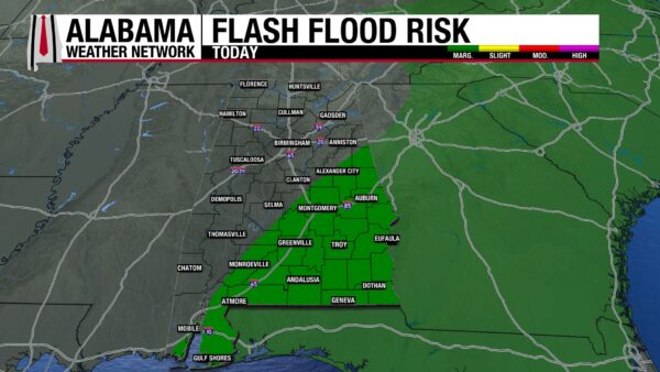
A Marginal Risk (1/4) for Excessive Rainfall is in place from northwest of Alexander City to south of Mobile today. Isolated flash flooding is possible.
QUIET NIGHT
The rain will clear out in the evening, leaving clear skies and a quiet night ahead. Lows will reach the upper 40s from the north to south-central Alabama. This south will sit in the lower 50s.
CALM MONDAY AND TUESDAY
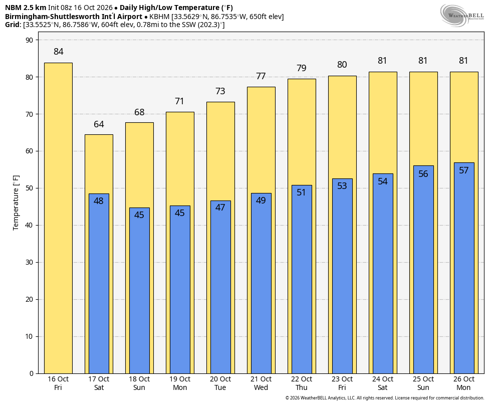
A high-pressure regime associated with an upper-level ridge will take the place of today’s low-pressure system, bringing warmer temperatures and quieter weather to the state. Monday will be sunny in the afternoon, with highs around the upper 60s to low 70s across the state. Tuesday will see an increase in clouds, but highs will still reach the lower 70s statewide.
WARM AND POSSIBLE RAIN WEDNESDAY
Highs will continue to increase into the low to mid 70s north and upper 70s south. There is a very low, but non-zero chance of showers Wednesday.
SUMMER SNEAK-PEAK THURSDAY
The state will stay mostly dry, with rain chances not increasing until nighttime. Highs will reach the impressive upper 70s through the northern half of the state and the low 80s in the southern half!
RAINY FRIDAY AND SATURDAY
Rain chances increase statewide Friday, with thunderstorms possible. The highs will decrease slightly, only reaching the lower 70s, but with a few areas keeping the potential for a mid-70 reading. The rain chance continues into Saturday, and highs will be in the upper 50s to mid 60s north, and upper 70s to lower 80s farther south.
GLOOMY BEACH WEATHER
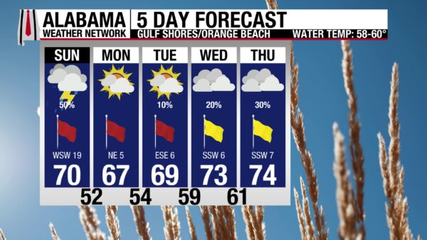
The active atmosphere today has encouraged an active ocean. The rip current risk is high, which means the water is dangerous for all levels of swimmers. The high temperature today will be in the low 70s, winds will be strong, blowing at 20-25 mph, and skies will be on and off gloomy. A chance of showers and thunderstorms lingers as well. Today is better spent inside!
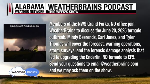
WEATHERBRAINS 1048
This week’s WeatherBrains episode takes a deep dive into the June 20, 2025, tornado outbreak with Mindy Beerends, Carl Jones, and Tyler Thomas from the NWS Grand Forks, North Dakota, office. Email your questions to [email protected]!

TODAY IN WEATHER HISTORY
On February 15, 1819, in the later five o’clock hour, a tornado touched down near the Washington-Mobile County line. It moved northeast and lifted near the then capital of the state, St. Stephens. The path was 27.5 miles long and cut through forested land. Tree debris was reportedly hurled high into the air, and one Choctaw Indian was killed. Settlement was sparse at the time, and other details are limited. A rating is unavailable as well, as the Fujita scale, which bases severity on how much damage occurred, was not invented until 1971. There is no way to go back and assess the damage from that time. This tornado stands as one of the earliest known fatal tornadoes in Alabama.

IMAGE OF THE DAY
James Spann reposted @barrybutler9’s X post yesterday morning, captioned, “Pink and Red start to St. Valentine’s Day. Saturday sunrise in Chicago.”