


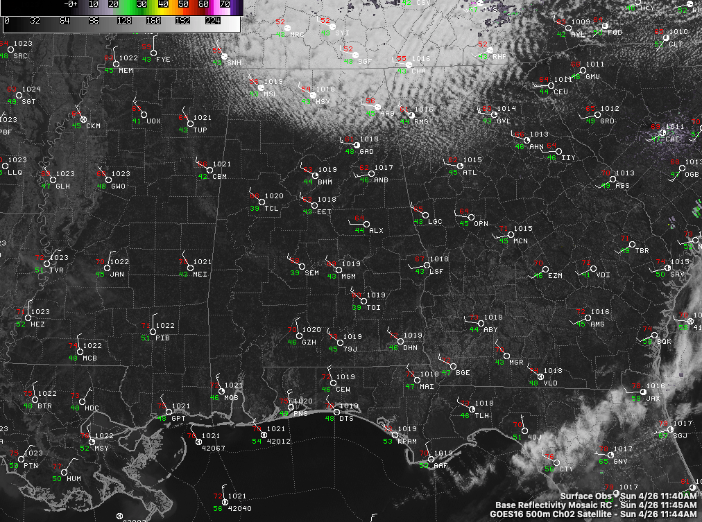
This last Sunday in April dawned mostly clear and cool across Alabama with temperatures in the upper 40s to lower 50s. Wraparound moisture and colder air aloft on the backside of low pressure over West Virginia is producing a substantial field of stratocumulus clouds over the Tennessee Valley of North Alabama, extending down as far as Blount, Etowah and DeKalb Counties.
It is cooler and breezy today behind a cold front that pushed through the state on Saturday. Those and maybe even a few sprinkles will affect the Tennessee Valley today, keeping afternoon readings there in the upper 50s to lower 60s. Elsewhere, highs will be in the upper 60s to lower 70s.
Tonight’s lows will be in the lower 40s across the Tennesse Valley, with middle 40s across the I-20 Corridor and middle to upper 40s south. Some of the normally colder locations in North Alabama will probably see a reading or two in the upper 30s.
FOR YOUR MONDAY: Tomorrow will be partly cloudy and slightly cool, with a noticeable northerly breeze. After that refreshing start, highs will be in the upper 60s up north to lower 70s around Birmingham to upper 70s down south. Monday night lows will be in the upper 40s to lower 50s.
TUESDAY LOOKING GOOD: It’s going to be hard to beat Tuesday’s weather. Decent supply of sunshine, warm readings in the 70s, still fairly low humidity, and a freshening southerly breeze. It all adds up to a pretty nice day weatherwise, but changes will be in the offing.
STORMS RETURN EARLY WEDNESDAY: A sharp upper-level trough dropping through the Midwest will bring another chance of rain and storms to Alabama for early Wednesday morning through Wednesday afternoon. Severe weather is expected back over Oklahoma, Texas, Arkansas, Missouri, Kansas, and Louisiana Tuesday, but the system will be weakening as it edges into Alabama after midnight. Still, the storms could pack a punch with gusty winds and small hail.
SEVERE WEATHER LATER ON WEDNESDAY: By sunrise, the storms should be near I-20, just in time for instability to begin to increase. By early afternoon, areas south of I-20 could see a combination of moderate instability and deep-layer shear supportive of supercell storms. While the tornado threat appears to be low, you can never count April storms out in Alabama, so you know we will be taking it seriously, and we want you to as well.



