


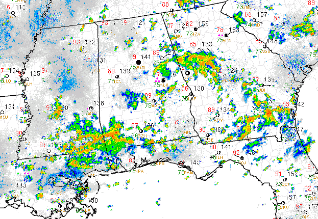
STREAK COMING TO AN END: That 40 day streak of consecutive 90F temperatures at the Birmingham Airport is the longest in the city’s record. Unless something amazing happens over the next few hours, the streak is dead. At 1 o’clock this afternoon, the temperature at the Birmingham Airport stood at 79F, far the 90s and 100 degree readings we have seen over the past forty days.
1.04 inches of rain is in the rain bucket for the day at the Airport. Many places got more, like 3.13 inches just east northeast of Alabaster and 2.20 at the Shelby County Airport. 1.53 inches of that 2.20 fell in the hour between 8 and 9 a.m.
STILL HOT ELSEWHERE: While the Birmingham metro area has been celebrating the rain and cooler temperatures, many spots across Alabama are still sweltering. While the mercury was struggling to get out of the 70s, it was 93F at Muscle Shoals and Huntsville and 89F at Tuscaloosa and Montgomery. Satellite imagery and Skycams showed the best sunshine over Northwest Alabama in places like the Quad-Cities and Hamilton, with partial sunshine in places like Cullman and Tuscaloosa. Highs will range from the upper 80s into the lower 90s in areas with sunshine, except over the Tennessee Valley, where mid 90s will be common.
LOOK AT THE RADAR: Showers and storms will be most likely over Northeast and East Central Alabama this afternoon, in the vicinity of the low. Additional storms were forming in the more unstable air over Northwest and North Central Alabama. These storms will rotates south and southwest in the circulation around the low. Some of them will be heavy, with lots of rain and lightning.



