


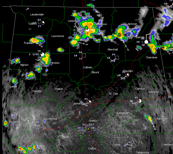
Strong thunderstorms continue across the Tennessee Valley this afternoon from Franklin County over to Limestone, Morgan and Madison counties then into Jackson and over to DeKalb and Cherokee Counties.
The strongest storm are near the Huntsville International Airport moving into the City of Huntsville and north of Guntersville.
Showers trail back into Winston, Marion and Lamar Counties in West Alabama.
Further south, storms extend from parts of Greene and Hale through Sumter, Marengo, Wilcox and into South Alabama.
In East Alabama, an isolated thunderstorm is over eastern Clay County near Lineville.
TROPICAL DEPRESSION 6 FORMS
TD #6 has formed in the Atlantic this afternoon. Complete information coming up shortly.



