


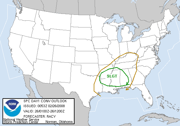
The cold front extends from a surface low near Little Rock into east Texas tonight. Out ahead of the front, strong southerly low-level flow is bringing moisture northward into LA, MS, and southern AR. So far, a “cap” of warm air aloft has kept widespread thunderstorms from forming, but the upward motion associated with the system is cooling the atmosphere aloft, and helping the cap to break.
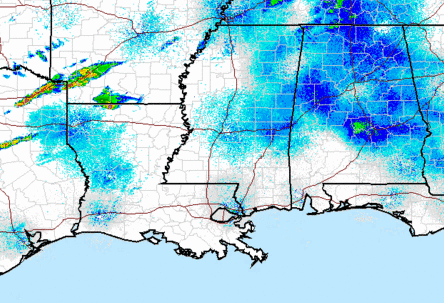
Storms have developed rapidly over the past couple of hours from north of Shreveport into southern Arkansas and NE Texas.
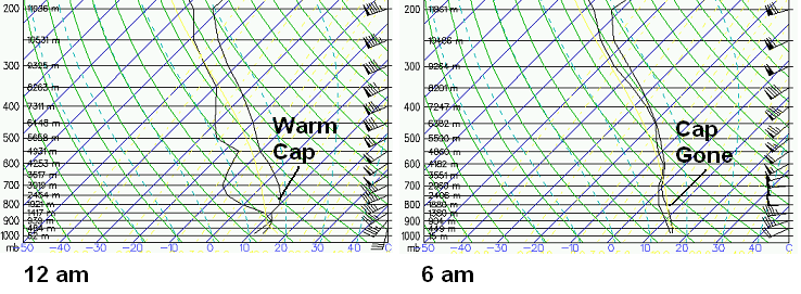
Models show that the southerly moisture transport may actually increase somewhat as the system heads rapidly east overnight, with dewpoints near 60 as far north as BHM by early morning. The 00 UTC (6 pm) balloon data at BHM show a cap in place here also, but models indicate that cap eroding between midnight and 6 am.
The latest NAM model shows thunderstorms moving into central Alabama after midnight. Instability will be limited, but with stronger wind shear in place than we originally thought, some of these storms may become severe. The main threat in Birmingham will likely be 2 am to 7 am. Damaging winds are large hail are possible with these storms, if they hold together. Right now, it looks like they will.
With weak instability, this should not be a significant tornado outbreak, but an isolated tornado or two cannot be ruled out. Be sure and have your NOAA Weather Radio turned on when you go to bed tonight.



