


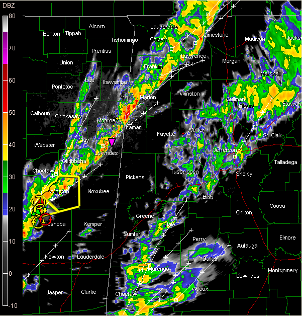
…LAMAR/MARION COUNTY STORMS WEAKER…
…WATCHING STORMS OVER CENTRAL MISSISSIPPI THAT COULD THREATEN LAMAR/PICKENS LATER…
…SHOWERS/SOME STORMS FURTHER EAST INCLUDING THE BHAM AREA NOT SEVERE
…ADDITIONAL RAIN FORMING OVER SOUTHWEST ALABAMA…COULD STILL BRING HEAVY RAIN OVERNIGHT TO EAST CENTRAL ALABAMA…
See info on MARION and LAMAR here.
The SPC is not very bullish on the storms causing much in the way of severe weather in Alabama. The air is certainly more stable, although wind shear is greater.
The showers over Central Alabama are in about a 35 mile wide band from Jackson and DeKalb Counties through Cullman/Blount/St. Clair and into Walker/Jefferson and Fayette/Tuscaloosa Counties.
Severe thunderstorm watch continues for Fayette, Lamar, Marion, Pickens, Tuscaloosa, Walker and Winston Counties till 7:00 PM CDT



