


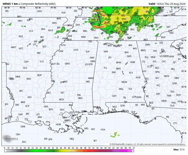
RADAR CHECK: We have an MCS (Mesoscale Convective System), or a big organized mass of rain and thunderstorms, over Tennessee early this morning. While most of the rain with this feature will stay north of Alabama, a few showers have developed southward into the Tennessee Valley.
For most of Alabama the best chance of seeing a shower or storm today is from noon to midnight, and we note SPC maintains a “marginal risk” (level 1/5) of severe thunderstorms for the entire state.
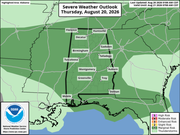
Heavier storms this afternoon and early tonight will be capable of producing strong wind gusts and lots of lightning. Odds of any one spot getting wet today are 30/40 percent. Temperatures will rise into the 90s.
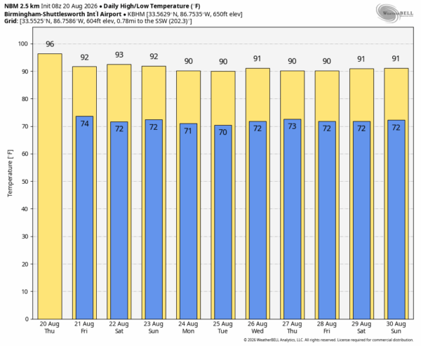
TOMORROW AND THE WEEKEND: Routine summer weather continues tomorrow with a partly sunny sky along with the usual risk of a passing afternoon/evening thunderstorm in scattered spots. Most communities will see a high in the low 90s. Global models are hinting that the air will be a little drier over the weekend with fewer showers around; highs will remain generally in the low 90s both days.
NEXT WEEK: Afternoon showers and storms will be widely scattered Monday and Tuesday, then becoming more numerous over the latter half of the week. Expect high temperatures between 88 and 94 degrees… See the video briefing for maps, graphics, and more details.
FOOTBALL WEATHER: High school football is back with games tonight and tomorrow night! Temperatures will fall through the 80s during the games, and there will be thunderstorms around the state in scattered, random places during the evening hours. No way of knowing in advance exactly when and where they pop up; you simply have to watch radar trends. For the tailgaters temperatures will rise into the 90s again this afternoon.
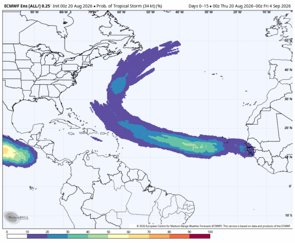
TROPICS: The Atlantic basin remains calm and tropical storm formation is not expected through the weekend. Global models suggest a tropical wave will come off the coast of Africa next week… if by chance anything develops it will likely turn north well east of the U.S.
ON THIS DATE IN 1886: The 1886 Indianola Hurricane destroyed the town of Indianola, Texas and as such had a significant impact on the history and economic development of Texas. The storm ended the rivalry between Galveston and Indianola as the chief port of Texas. With the abandonment of Indianola and the unwillingness of the former residents to rebuild close to shore, Galveston became the essential Texan port until the 1900 Galveston Hurricane led to the rise of Houston as a major port. It was the fifth hurricane of the 1886 Atlantic hurricane season and one of the most intense hurricanes ever to hit the United States.
Look for the next video briefing here by 4:00 this afternoon… enjoy the day!



