


Guess it is time to give up on the idea of Ike not make it past 85W…. I don’t mind those that bash me on idea I had of a Florida West Coast landfall. Bashers and trolls are a way of life, and if you forecast the weather, you deal with them all the time. The only other issue that brings out more negativity here is winter weather. Bash away, just don’t use any ugly words.
But, I suggest the idea of a Florida West Coast landfall is not totally off the table with so much model madness going on. The idea of a stall, then eastward turn, while not likely now, has happened before, you know.
Lets take an early morning look:
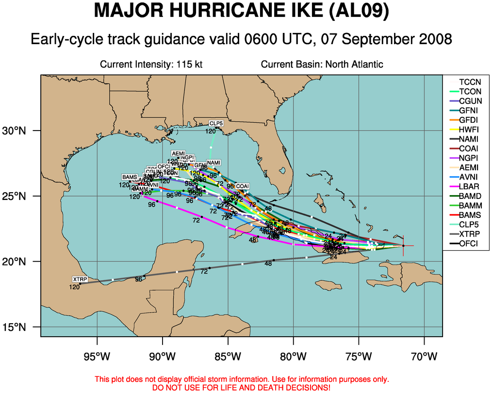
Ike has not played nicely with anyone… the position is simply too far south to be heavily influenced by the mid-latitude westerlies. Forecasts from the NHC and just about everyone else four days ago were not even close; the NHC track had Ike going right into Miami; but clearly it will pass well to the south, over Cuba. That is why NHC always mentions the disclaimer “there can be great forecast errors at Days 4 and 5” in their product, and why I always say “nobody knows the final destination”. Lets say it again:
Nobody knows the final destination and intensity of Ike. Ike does not read blogs or NHC discussions.
The interaction with the island will result in some weakening; Gustav never recovered full strength after the passage over Cuba, as you recall. It remains to be seen how Cuba will impact Ike, along with the upwelling over the Gulf from Gustav.
Some global model notes:
*The 00Z ECMWF takes Ike to near Galveston this weekend (Kevin Selle will like the sound of that; if you listen to WeatherBrains, you understand)
*The 06Z GFS brings Ike into the Louisiana coast a little west of Morgan City Saturday morning.
*The Canadian brings Ike to near Gulf Shores Friday night
*The JMA (Japanese) global model takes Ike southwest, toward the Mexican coast
*The UKMET also takes Ike far to the south, in the general direction of Mexico
Interaction with the mid-latitude westerlies will determine the fate of Ike, and as we get deeper into September they tend to be stronger and farther to the south. Models are all over the road on the amplitude and position of waves; it now is simply too early to call a landfall. I still maintain the idea that is it very hard for a system north of 25N going all the way across the Gulf to Texas this time of the year (September/October).
We continue to wait and watch…



