


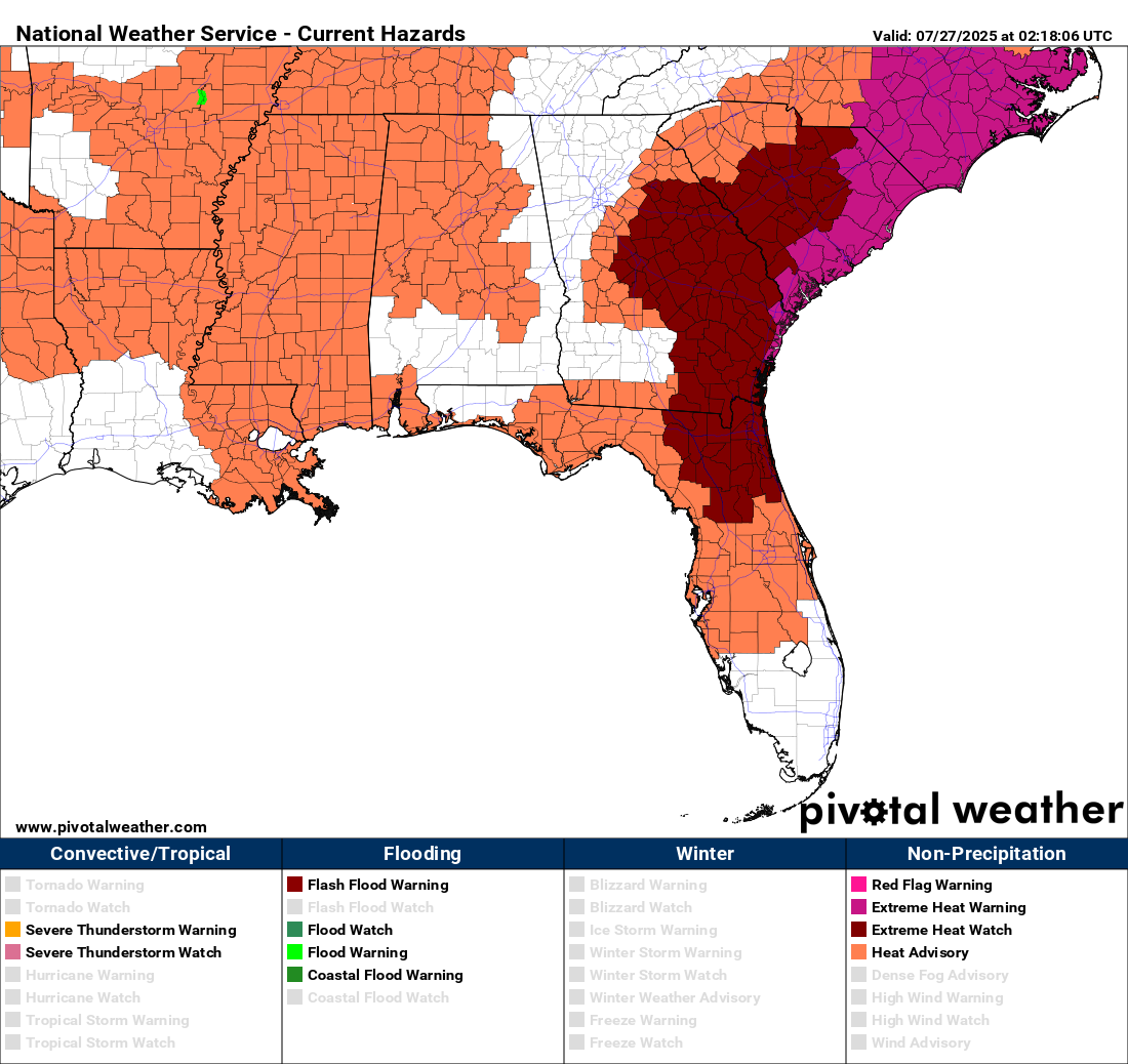
As we head into the final stretch of July, the grip of deep summer is unmistakable across Alabama. The Dog Days are fully upon us — long days, stagnant nights, and now a long-duration heat wave unfolding across the Deep South. With high pressure anchoring over the region and ridging aloft, we’re seeing little relief from the sun, save for an isolated thunderstorm or two. The heat isn’t just uncomfortable — it’s dangerous, with heat advisories already posted and more likely in the days to come.
SUNDAY SIZZLE SETS THE STAGE
Sunday will bring searing heat across Central and North Alabama as high pressure builds overhead. Highs will climb into the mid 90s, and with dewpoints in the mid 70s, heat index values will easily reach or exceed 105 degrees in many areas. A Heat Advisory is in effect from 11 AM to 9 PM for much of the state, including Jefferson County, where the maximum heat index is projected to top 105. With only isolated showers possible — and mainly north of I-20 — don’t count on cooling from the skies. Overnight lows will struggle to fall below the mid 70s, offering little relief.
HOTTER STILL TO START THE WEEK
Monday and Tuesday appear even hotter. Actual air temperatures will rise into the upper 90s, and with moisture remaining abundant, heat index values of 106 to 110+ are expected. A continuation of the Heat Advisory is likely, but parts of North Alabama may flirt with criteria for an Extreme Heat Warning, especially in the Shoals. Rain chances remain near zero on Monday and barely touch 10% Tuesday, with only the faintest signal of relief coming in the distance. For those working or spending time outdoors, take frequent breaks, hydrate often, and check on pets, children, and elderly neighbors.
MIDWEEK FRONT FINALLY BRINGS STORMS
By Wednesday, the ridge begins to weaken as a surface front sags southward. Moisture will begin to pool, instability will increase, and showers and thunderstorms become more widespread — especially by Thursday and Friday. These storms may be strong, with localized heavy downpours and gusty winds, and will offer some degree of cooling. Highs will still reach the lower 90s, but more clouds and scattered afternoon storms should help ease the intensity of the heat wave by late week.
A MORE NORMAL WEEKEND AHEAD
The first weekend of August is looking more like typical summertime Alabama: highs in the low 90s, scattered showers and thunderstorms each afternoon, and a return to our usual heat-humidity-storm rhythm. While no major fronts are expected, convective coverage should remain healthy, especially on Saturday.
PEEKING INTO WEEK TWO
Early signs for the week of August 4 suggest a continuation of the thunderstorm regime, especially as ridging weakens over the Southeast and an upper trough influences the eastern U.S. While long-range details are fuzzy, we expect above-normal rain chances and seasonably warm temps in the 88–92° range, with some days offering better coverage of showers and storms than others.
SEVERE WEATHER OUTLOOK
The severe weather risk on Sunday remains well to the north of Alabama. A Slight Risk (level 2 of 5) is in effect for parts of Minnesota, Wisconsin, and Upper Michigan, where an upper shortwave and rich instability will support a corridor of organized storms. In the Mid-Atlantic, isolated pulse storms may produce localized damaging wind gusts. Alabama is not included in any severe risk zones.
TROPICAL WEATHER OUTLOOK
The tropics remain quiet for now. The National Hurricane Center reports that tropical cyclone formation is not expected in the Atlantic basin over the next 7 days.
BEACH FORECAST: BEAUTIFUL BUT HAZARDOUS SURF
If you’re headed to the beautiful beaches of Alabama or Northwest Florida on Sunday, expect sunshine, highs in the low to mid 90s, and water temperatures in the mid 80s. Surf heights will be around 1 to 2 feet, but rip current risk remains MODERATE from Dauphin Island to Panama City Beach. Stay alert and swim near lifeguards. UV indices are extreme, so reapply sunscreen frequently and stay hydrated.
WEATHERBRAINS
Monday night’s WeatherBrains will be a homegrown episode, as a guest miscommunication shifted our schedule. The originally planned guest will now appear August 4. Catch the episode live Monday at 7 PM CDT on YouTube.com/WeatherBrains or anytime on all major podcast platforms. Learn more at WeatherBrains.com.
THIS DAY IN WEATHER HISTORY IN 1819
The Bay St. Louis Hurricane of 1819 passed over its namesake city on this date. The hurricane pushed a 6-foot storm surge over the Gulf Coast. Nearly every structure along Bay St. Louis was destroyed. The surge pushed into Mobile Bay, where the funnel shape forced the water to rise into the city. A ship was blown onto Dauphin Street in Mobile. Alligators, snakes, and huge snapping turtles were driven from their bayou habitats into flooded city streets, resulting in several deadly attacks on humans. The U.S. Sloop of War Firebrand was capsized and driven ashore on Cat Island off the Mississippi Coast. In total, 175 people died. The hurricane made landfall in nearly the same location as Hurricane Camille would 150 years later.



