


Daily Weather Briefing
Sunday, March 22, 2026
ALABAMA THIS MORNING
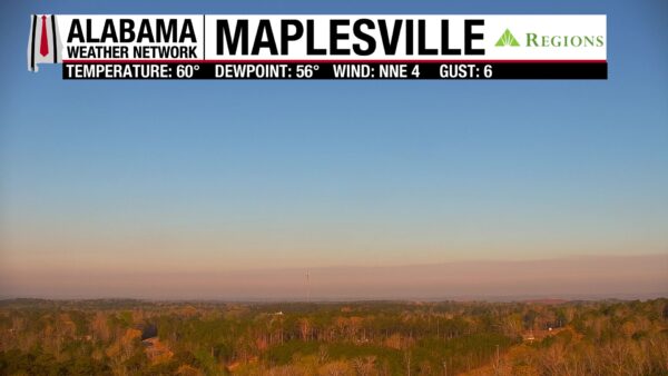
A calm, pleasant Sunday morning greets Alabamians. The northern two-thirds of the state are clear, while the southern third sees cloudy skies. Temperatures sit in the upper 50s and lower 60s everywhere but in the east, which sits in the lower 50s.
ALABAMA 7 DAY FORECAST
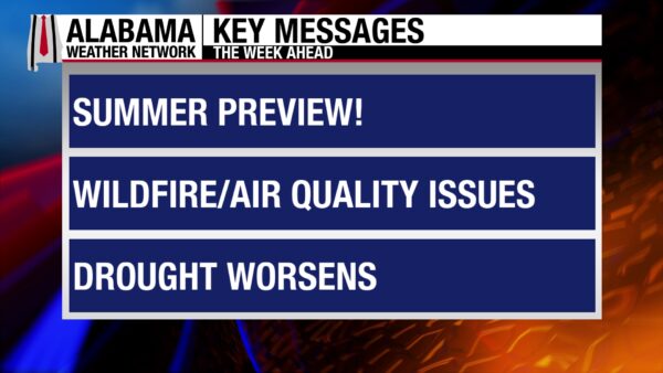
Today will be another dry and warm day, then a dry cold front moves through the state Monday. This will keep highs slightly cooler than they’ve been this weekend through Tuesday. There is a low chance of isolated showers Tuesday and Wednesday. Thursday will be quiet, then another cold front passes Friday into the weekend.
SUNDAY: ANOTHER WARM DAY
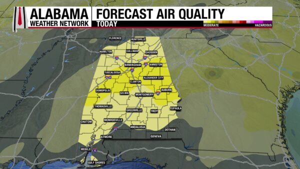
Today will be the warmest day of the week as southwesterly flow brings warm air to the state. Highs will reach the mid 80s statewide, while the coast will sit in the 70s. A few high temperature records could be broken today. Cumulus clouds can be expected across the state. Air quality may be poor at times as smoke and haze enter the air from wildfires and prescribed burns. If you have respiratory concerns, exercise caution outside today.
CLOUDS INCREASING OVERNIGHT
As we head into tonight and early tomorrow morning, clouds will increase from the north and south simultaneously. This will keep lows to the upper 50s and lower 60s statewide.
DRY COLD FRONT PASSES MONDAY
A dry cold front will pass through Alabama Monday, bringing a very low chance for showers to the north. The air behind the front is only a bit cooler than the airmass we’ve experienced this weekend. Highs will sit in the 70s in the northern half of the state and the low to mid 80s in the southern half.
COOLER AIR CONTINUES TUESDAY
The “cooler” air continues to filter in on Tuesday, aided by the wedge (cold air from the Appalachian Mountains). This will cause highs to range from the upper 60s in north and east Alabama, the lower to mid 70s for parts of west and central Alabama, and then the southwestern portion of the state will be in the upper 70s and lower 80s. There is a very low chance of a quick, isolated shower or thunderstorm.
WARMING TREND BEGINS WEDNESDAY
By Wednesday, warmer temperatures will return. Highs will climb back into the lower 70s in the northeast and east, the mid to upper 70s through northwest and parts of central Alabama, and the upper 70s to lower 80s for the southwest.
Highs increase dramatically Thursday, with all of the state expected to be in the mid 80s.
ANOTHER COLD FRONT FRIDAY
Another cold front is expected to pass through the state Friday, and it will be dry as well. Highs Friday will range from the upper 60s to the upper 70s in the north and the mid to upper 80s centrally and in the south.
The cooler air from Friday’s front will reach the state Saturday, keeping temperatures to the lower 60s north, lower to upper 70s in north-central Alabama, and the upper 70s and lower 80s in the southern half of the state.
ANOTHER GORGEOUS DAY
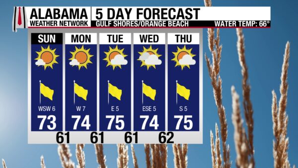
Today continues the good beach weather pattern we’ve seen over the past several days. The high will be in the low 70s, sunny skies will lead to a very high UV Index, and winds will blow from the southwest at 5 to 10 mph. Cool off in the calm waters, where the rip current risk is low, and the water temperature is in the mid 60s. Nice beach conditions will persist throughout the week.
WEATHERBRAINS 1053
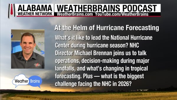
Tomorrow’s WeatherBrains episode features National Hurricane Center Director Michael Brennan! He and the team will discuss operations, decision-making, and challenges of hurricane season. Watch the episode here or listen wherever you get your podcasts.

TODAY IN WEATHER HISTORY
March 22, 1992 – Flushing Bay Crash
The National Transportation Safety Board investigated the March 22, 1992 accident involving USAir Flight 405, a Fokker F-28 that crashed during takeoff from LaGuardia Airport after the aircraft stalled shortly after liftoff. A stall occurs when the wings can no longer produce enough lift to keep the airplane flying. Lift depends on the smooth flow of air over the wing, and it increases as the angle of attack—the angle between the wing and the oncoming airflow—becomes steeper. However, if this angle becomes too great, the airflow separates from the wing’s surface and lift drops sharply, causing the aircraft to stall. In this accident, investigators determined that the aircraft’s wings were contaminated by ice after about 35 minutes of exposure to precipitation, which disrupted the airflow over the wings and reduced the margin before a stall could occur. Weather conditions included snow, fog, and wet snow covering the runway, with visibility near minimum limits and braking advisories in effect. The aircraft had been deiced twice with Type I fluid, but delays between deicing and takeoff likely allowed ice contamination to persist. The flight crew relied on visual inspections of the wings and did not perform a walkaround inspection before departure. During the takeoff roll, the aircraft accelerated normally, but the captain rotated the aircraft at about 110 knots, several knots below the expected speed of about 124 knots, which increased the angle of attack during liftoff. With the wings already affected by ice contamination, the airplane rapidly lost lift and stalled immediately after becoming airborne. Cockpit voice recordings captured normal engine operation and stall warning alerts just before impact. The aircraft struck the ground about 4,250 feet from the runway threshold, breaking into several sections, with the main wreckage partially submerged in water. The aircraft was destroyed in the crash and was valued at approximately $13.12 million. The investigation concluded that industry and Federal Aviation Administration procedures at the time did not adequately address the risks of wing contamination during winter operations. The accident highlighted the dangers posed by even small amounts of ice on aircraft wings and led to recommendations to improve deicing procedures, icing detection methods, pilot training, airport delay management, and emergency response protocols during winter weather operations.
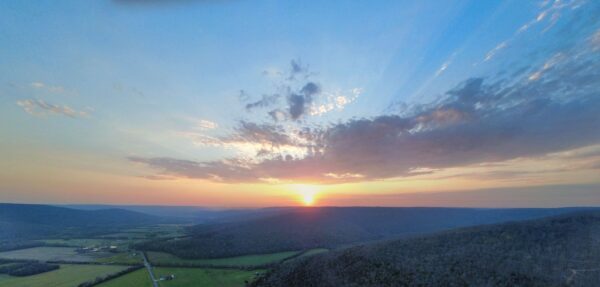
IMAGE OF THE DAY
Skywatcher Daniel Harbin took this wonderful picture of the sunset in Trenton using his drone yesterday!



