


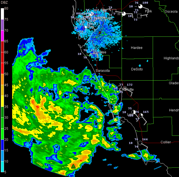
Thunderstorms are growing in the southeastern Gulf tonight, associated with what seems to be a developing low.
You can see the spin of the circulation in the echoes from the Fort Myers radar. At the surface, winds at Fort Myers are out of the southeast. At Sarasota, they are out of the east. I could not find a westerly wind, even at Key West, so it may not be closed off yet.
The NHC has classified it as disturbance 91L. It should track toward the Alabama and Northwest Florida coast. Even if it doesn’t develop into a tropical cyclone, it will bring quite a bit of heavy rain and thunderstorms to the Central Gulf Coast and deeper into Alabama.



