


Click image to enlarge.
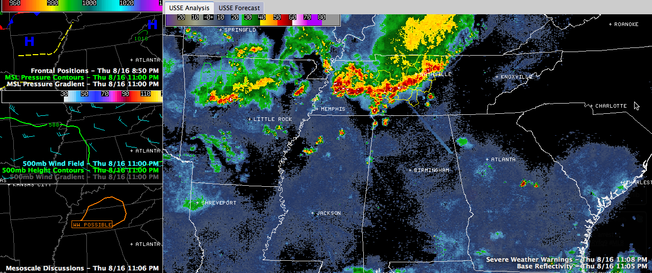
Thunderstorms increased markedly in intensity late this evening over Central Tennessee.
Several severe thunderstorm warnings are now in effect for areas along and ahead of the line, including the Nashville Metro. The SPC talked about issuing a watch about 90 minutes ago, but that doesn’t look likely now.
These storms are sinking southeastward at 20 mph. They will reach the Tennessee Valley of North Alabama before 2 a.m. A few storms were already developing around the Shoals of Northwest Alabama.
The storms are associated with a decent upper trough out ahead of a frontal system that is stalled over the Midwest right now. That front will be well into Northwest Alabama by tomorrow evening.
The activity should lose a bit of intensity over the next few hours as they push into North Alabama. This could make for a rainy and rather stormy morning over Northwest and North Central Alabama on Friday.
How far south these storms can push is yet to be seen, but they may make it as far south as I-20 during the pre-dawn hours.
Areas that see morning activity could be less severe weather prone as the front moves in later in the day. Areas that don’t see rain and storms could see severe weather in the afternoon ahead of the arriving front. We will get a look at the new SPC severe weather outlook for Friday about 1 a.m. It should include a good bit of North and Central Alabama.
WE will have any Central Alabama warnings that might happen during the night for you right here and bring you updates as necessary.



