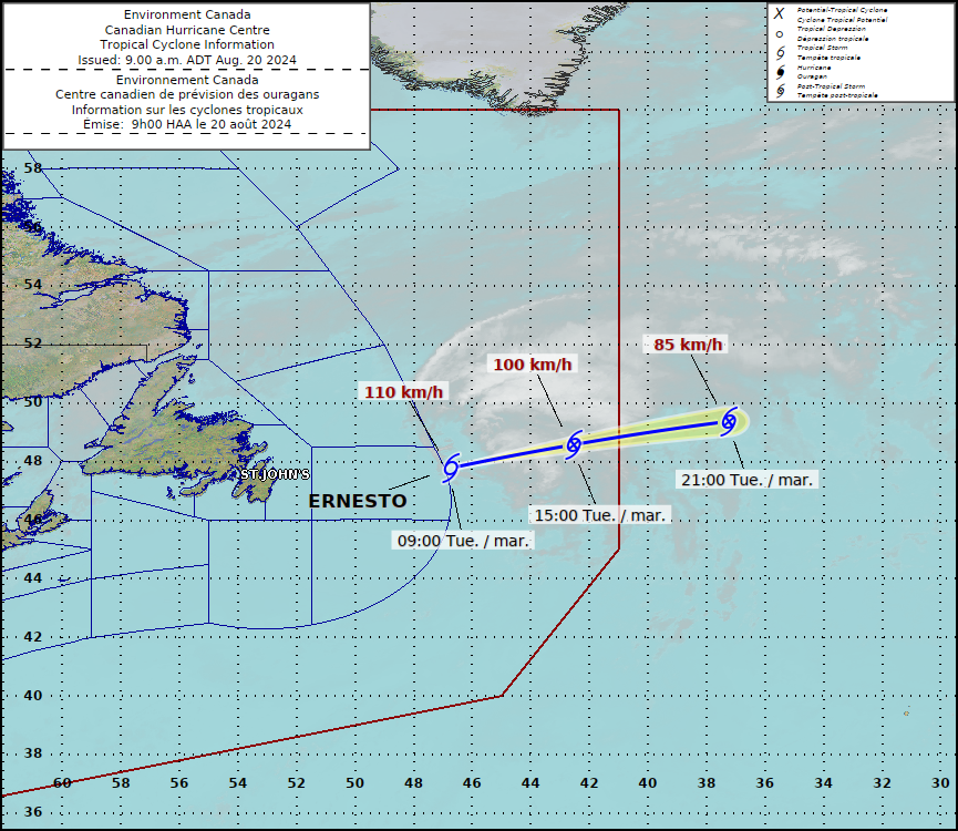
Good Tuesday Morning! We have just received the last advisory from the National Hurricane Center on Ernesto. The end is near for this system. It is holding on for dear life though about 420 miles ENE of Cape Race Newfoundland.
Here are 1500 UTC Stats:
SUMMARY OF 300 PM GMT…1500 UTC…INFORMATION
———————————————-
LOCATION…49.0N 44.7W
ABOUT 420 MI…675 KM ENE OF CAPE RACE NEWFOUNDLAND
MAXIMUM SUSTAINED WINDS…70 MPH…110 KM/H
PRESENT MOVEMENT…NE OR 55 DEGREES AT 37 MPH…59 KM/H
MINIMUM CENTRAL PRESSURE…987 MB…29.15 INCHES
Ernesto is now a very strong post-tropical cyclone. Weakening is forecast over the next 24 hours. By late Wednesday, the storm be absorbed in a frontal system and will dissipate. Still a large wind field with tropical storm force winds out 230 miles.
Still dealing with swells along the northeast US coast and Atlantic Canada. Rip current risk and surf remains high.
So what is next? Right now….it is quiet but we can’t let our guard down. It has been an active season so far and we have not hit peak season. Any storms that move into the mega-warm waters of the Gulf and Atlantic have the potential to strength. How warm are the waters?? Record warm!
And there it is: the highest ocean heat content in the Gulf on record. pic.twitter.com/LMJJjUKOdm
— Brian McNoldy (@BMcNoldy) August 20, 2024
We will take the break for sure….but will be watching things closely and will have any updates for you on The Alabama WX Weather Blog!