


…IKE SLIGHTLY WEAKER…
4 PM FAST FACTS
LOCATION 21.1N/74.6W…75 MILES NNE OF GUANTANAMO CUBA
MOVEMENT: W-14
MAX WINDS: 120 MPH (CATEGORY 3)
CENTRAL PRESSURE: 945 MPH
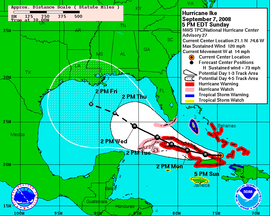
Ike continues westward this afternoon. It is slightly weaker according to the Air Force plane, despite the fact that the pressure has fallen a tad. It is expected to begin moving more west northwest tonight or Monday. It will weaken over Cuba.
Ike should emerge over the southeastern Gulf by Tuesday morning. It will begin to re-intensify over warm water as it moves northwest into the Central Gulf. A weak ridge is expected t omove it more westward by mid-week.
The eventual landfall is still way to difficult to predict. But suffice to say there will be a large and dangerous hurricane in the Central Gulf this week. We will all be nervously watching.



