The snowfall has increased quite a bit in the BHM area over the past 30 minutes…indicating that the dry air in the lower-levels of the atmosphere may finally be eroding. Take a look at the balloon data chart from this morning at Calera.
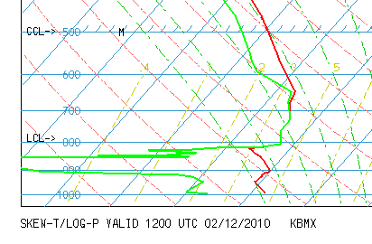
The red line is the temperature profile with height, and the green is dewpoint. Notice the low dewpoints, or dry air, aloft. Even though radar has shown light snow over Tuscaloosa and Birmingham for hours, most of it has been evaporating or sublimating before it could reach the ground so far. However, as this happens, it moistens up the atmosphere, and if snow falls long enough it will eventually reach the ground. That is happening now, and the increase in intensity tells me the air is now moist and snow will pick up over the next few hours.
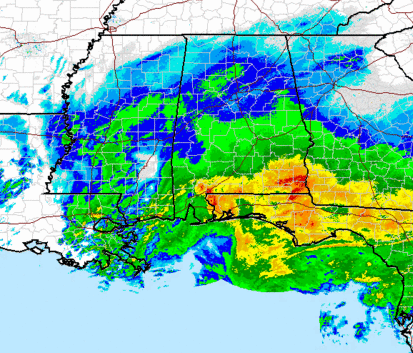
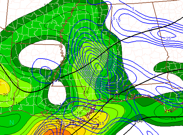
The upper-level disturbance we’ve been talking about will move across central Alabama this afternoon, and we still expect 1″ or so of snow here in BHM, with amounts getting heavier as you go SE.
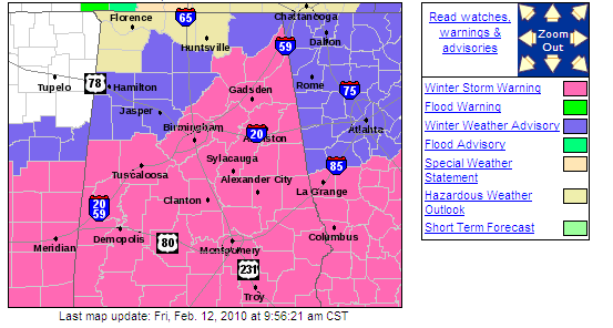
Temperatures in central Alabama have fallen to 33 at higher elevations and 37 in the valleys, and with snow falling, they will continue to fall. So, accumulations may begin by lunchtime. A winter storm warning continues in effect for Tuscaloosa, Jefferson, Shelby, Calhoun, and Etowah counties, and most of Alabama south of a line from Fayette to Warrior to Guntersville, so the NWS still feels this is a dangerous winter storm. Area offices may want to consider allowing employees to go home earlier than normal today in the TCL, BHM, ANB metro areas.