


That’s a word you don’t hear very often today: thundershowers.
Although I understand there technically isn’t a prohibition against the use of the word in National Weather Service circles, it has certainly fallen out of vogue.
Perhaps it’s because it is not as menacing a word as “thunderstorms”, and technically a single lightning bolt makes a shower a thunderstorm, and shelter needs to be taken against the threat of being struck. In fact, people need to become aware of developing showers that pose the threat of producing lightning, because waiting until you hear thunder means there has already been one lightning bolt and that first bolt is just as deadly.
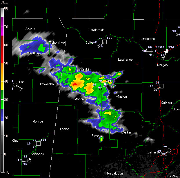
We have thundershowers over Northwest Alabama this morning. They are moving slowly, if at all, to the southeast and seem to be weakening a bit. So a decent light to moderate rain is the word for parts of Franklin, Marion, northern Fayette, western Winston and northwestern Walker Counties.
Clouds are fairly thick across much of the northern half of Alabama, north of a line from Fayette to Calera to Rockford. South of that, the sunshine is bright and things are heating up. With a moist airmass and a trough close by, thunderstorms should become more widespread by afternoon. Some of them could be strong to severe again today with damaging winds headlining the list of threats.
The latest advisory on Tropical Storm Alex just cleared the wire. It is 165 miles from Chetuman on the Yucatan Peninsula moving WNW at 9 mph. It will reach the coast of Belize or Mexico tonight. Top winds are up to 45 mph. It is expected to weaken slowly to a depression during the trek across Yucatan but re-emerge into the southwestern Gulf and is now forecast to become a hurricane before making landfall in five days over northern Mexico.
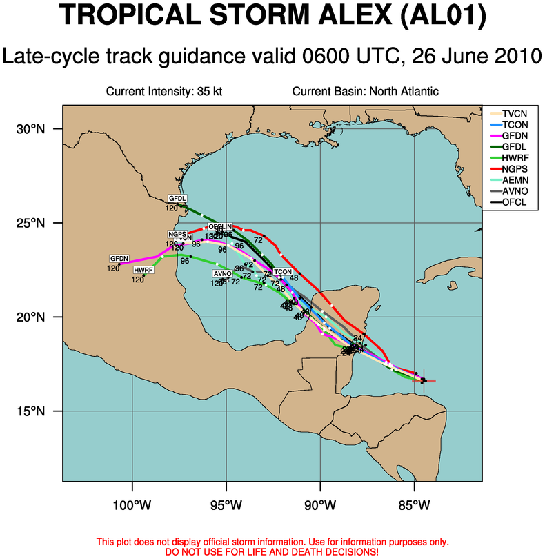
Overnight track guidance really became concentrated on a solution that indicates eventual landfall in northern Mexico. Even the GFS ensembles are now on board more with that idea.



