


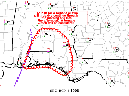
Mesoscale Discussion 1008
NWS Storm Prediction Center Norman OK
0833 AM CDT Sat Jun 19 2021
Areas affected…southern AL…FL Panhandle
Concerning…Tornado Watch 284…
Valid 191333Z – 191430Z
The severe weather threat for Tornado Watch 284 continues.
SUMMARY…The risk for a tornado or two will probably continue
through the morning and into the afternoon. A tornado watch will be
considered later this morning to the east of tornado watch 284.
DISCUSSION…KMOB radar imagery shows a couple of embedded rotating
updrafts over southern AL and far western part of the FL Panhandle
as of 1330 UTC. The 12 UTC Tallahassee raob showed ample buoyancy
(1400 J/kg MLCAPE). The raob likely sampled to the east of the
moist axis, which was located farther west over the western FL
Panhandle where surface dewpoints are 2-4 deg F higher.
The KEVX VAD data has shown an increase in 3-km AGL flow with speeds
increasing from 40 to 50 kt during the past 2 hours. As a result,
the hodograph has enlarged and around 240 m2/s2 0-1 km SRH is noted.
Given the very moist/strongly sheared low levels, it seems plausible
it will continue to remain favorable for mesocyclogenesis during the
morning. The stronger and more persistent circulations will be
capable of a couple of tornadoes. As the primary band translates
east and north during the morning, the risk for a tornado will
probably spread into parts of southeast AL and potentially the
central part of the FL Panhandle later this morning and into the
afternoon.



