


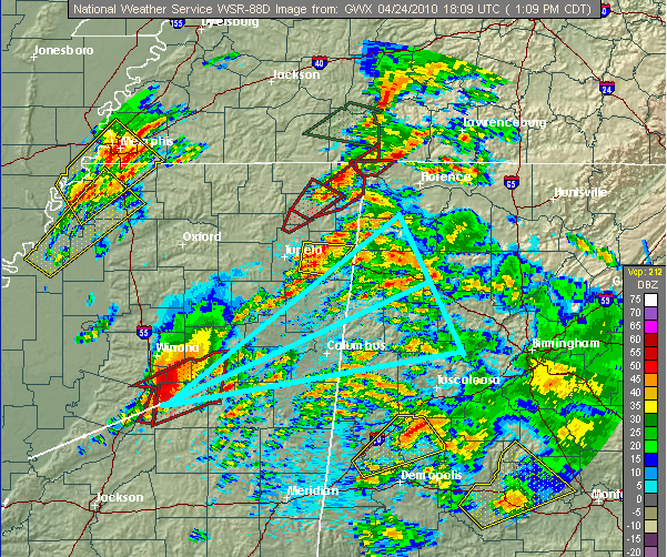
There are reports of structural damage and possibly an EF4 tornado in Yazoo City earlier with the cell that continues to move across central MS. This storm will continue to move through an area with very high wind shear and instability, so it could hold together for a while longer, and maybe make it to west Alabama after 2 pm. There is a lot of uncertainty with the track…these storms sometimes turn right, so areas from Pickens and Tuscaloosa counties all the way up to Hamilton need to watch this storm carefully. It is a classic supercell that could produce multiple large tornadoes.
The instability is making it into west Alabama now, and it looks like the cap of warm air may be breaking. As the scattered storms concentrate into less, but larger cells, additional tornadoes are possible in west and cnetral Alabama from those storms this afternoon also. There are several storms that concern us now, including ones near Moundville, south Bibb County, and in Autauga County. These could go supercell and produce a tornado anytime. Also, other storms could develop anywhere from north MS into north and central AL, as the air destabilizes more.
This is the most dangerous situation we have faced since February 6, 2008. Please continue to monitor the weather and have a tornado plan wherever you are.



