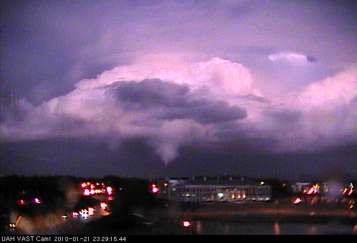
This is a picture of the supercell storm and tornado at 5:29 pm CST, taken from a VAST camera on the roof of the NSSTC, the building where UAH Atmospheric Science is. Thanks go out to NOAA/THOR for the funding that allowed these camera shots, and the close-up radar and surface analysis that will follow of this very rare tornado in a low-shear, cool environment (dew point only 56).

Published on: January 21, 2010 at 6:48 PM
Related Articles
June 30, 2026 at 5:41 AM
Hot Summer Weather; A Few Spotty Afternoon Storms
SUMMER HEAT: Afternoon highs will remain in the 90s across Alabama through the rest of the week, with triple digit heat index values during the afternoon hours. A “heat advisory” is in effect for the state. During the peak of … Continue reading →
READ MORE
June 22, 2026 at 5:35 AM
Strong Storms Possible Across Alabama Later Today
ACTIVE DAY: Some rain is falling across the northwest corner of Alabama early this morning… the rain is more widespread to the north over western and middle Tennessee. Showers and storms are likely over North Alabama by mid to late … Continue reading →
READ MORE
