


Two severe thunderstorms over eastern Mississippi at this hour.
One has a tornado warning on it for northwestern Lauderdale and Newton Counties in Mississippi. The storm that contains a possible tornado is near Newton.
The other severe storm is southwestern of the lead storm.
They are moving northeast at 50 mph, which is really quick.
This is the two hour projected track on these two storms…
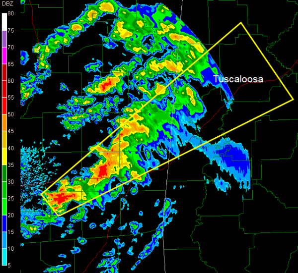
As you can see, these lead storms will be in the Tuscaloosa area before 9 p.m.
The situation over Central Alabama will become prime for severe weather over the next few ours as high dewpoint air moves up into Alabama.
This is a troubling situation with the potential for significant tornadoes tonight. Tornado watches are in effect.
Stay tuned to the latest weather information through the overnight and be ready to take action if warnings are issued for your area.



