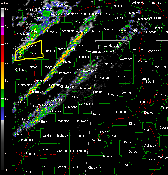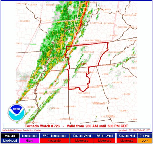
The SPC has issued a tornado watch for North and Northwest Alabama anticipating that the line of scattered storms that is over North Mississippi will intensify as it moves eastward.
It is a PDS (Particularly Dangerous Situation) Watch.
From the discussion part of the watch:
DISCUSSION…A PRE-FRONTAL BAND OF CONVECTION CURRENTLY DEEPENING
FROM N-CNTRL MS NWD TO E OF MKL IS EXPECTED TO EVOLVE INTO TSTMS
LATE THIS MORNING WITHIN A STRONGLY SHEARED AND
WARMING/DESTABILIZING ENVIRONMENT. THE COMBINATION OF EFFECTIVE SRH
OF 300-400 M2/S2…MLCAPE OF 500-1000 J/KG AND THE POTENTIAL FOR
MORE DISCRETE STORM MODES SUGGEST A THREAT LONG-TRACKED SUPERCELLS
CAPABLE OF STRONG TORNADOES.
Central Alabama Counties included in the watch are:
Blount, Fayette, Jefferson, Lamar, Marion, Walker and Winston.
North Alabama Counties include:
Colbert, Cullman, Franklin, Lauderdale, Lawrence, Limestone, Madison and Morgan.
Here is current radar: