


The Storm Prediction Center has issued a tornado watch effective until 9 pm.. CDT for West Alabama.
Here is an approximation of the watch area in the form of the SPC parallelogram.
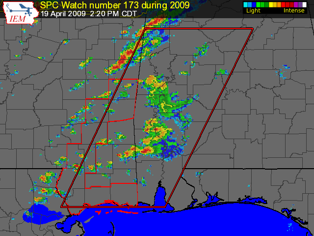
The official counties in the BMX warning area are: Bibb, Dallas, Greene, Hale, Marengo, Perry, Pickens, Sumter and Tuscaloosa.
At 2:30 p.m., storms were growing in intensity and coverage in the Noxubee and Kemper Counties area of eastern Mississippi. These will be storms of concern as they move into Pickens, Sumter, Greene and eventually Tuscaloosa Counties. Instabilities are increasing ahead of these storms and there is a great amount of low level shear. These storms will have the potential to produce tornadoes.
Storms over Fayete and southern Lamar Counties were not as strong but were still packing heavy rain, gusty winds and the potential for hail.
More widespread rain and storms were over the Northwest quarter of Alabama, but they will not have as great of a potential to become severe.
Back to the west, the airmass over Central Mississippi has become much more unstable as skies have cleared in the wake of the prefrontal trough that is producing the current storms over eastern Mississippi and western Alabama and ahead of the main cold front. Storms were forming in this airmass over Mississippi. We will deal with them later.



