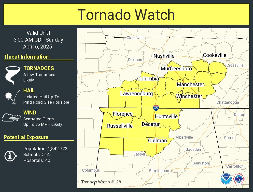
A volatile severe weather environment continues this evening across northeast Mississippi, northern Alabama, and southern middle Tennessee, where a cluster of intense supercells has already produced multiple confirmed tornadoes. The atmosphere remains primed for additional tornadic development, with strong low-level shear, backed surface winds, rich moisture, and moderate to strong instability in place. While some areas to the east have slightly lower dewpoints, the strengthening low-level jet and gradual moisture return will maintain the threat for strong tornadoes, damaging winds, and large hail well into the night.
Published on: April 5, 2025 at 8:35 PM
Related Articles
October 21, 2026 at 1:14 PM
Sunny Pleasant Days, Clear Cool Nights Through The Weekend
**No afternoon video briefing today due to travel** TONS O’ SUN: Another sunny afternoon for Alabama with temperatures mostly in the 70s. Tonight will be clear with a low between 45 and 52 degrees. Not much change in the Alabama … Continue reading →
READ MORE
October 21, 2026 at 5:30 AM
Long Dry Spell To Continue Through Next Week
DRY: Not much change in the Alabama weather situation through the weekend. Sunny pleasant days, clear cool nights. Highs in the 77-82 degree range through Friday, then in the mid to upper 70s Saturday and Sunday. The long dry spell … Continue reading →
READ MORE