


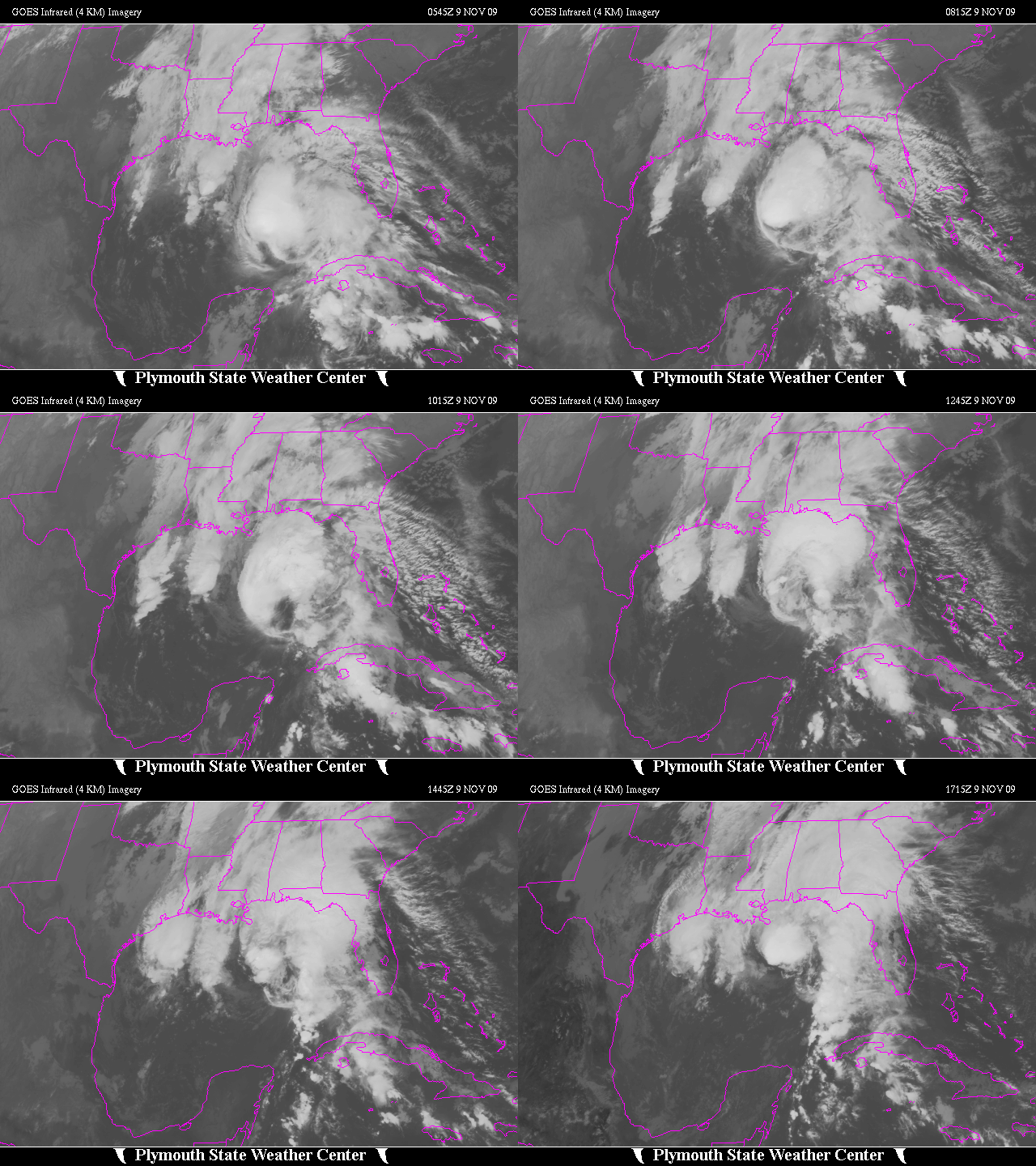
As expected, Ida has been weakening since last night, and was downgraded to a tropical storm this morning. On the satellite loop below, you can see how much of the thunderstorm activity associated with Ida pulled away to the NE of the center overnight. However, some re-intensification of the convection is occurring near the center today, so Ida may still make landfall as a strong Tropical Storm, with wind gusts near 75 mph in Pascagoula, Mobile, Baldwin County, and Pensacola. Tropical storm warnings are in effect along the coast.
Ida’s weakening overnight was associated with cool ocean water. A hurricane’s main intensity is due to low pressure caused by pulling in warm ocean water, and the humid air above it, high into the atmosphere. The warm, humid air is lighter than cold air, causing low pressure near the ground and strong winds. Ida was over water near 80 degrees yesterday, but it will be moving over water with temperatures in the 70s today in the northern Gulf. Some recent buoy/coastal reports indicate water temperatures of 69 in Mobile Bay, 68 at Pensacola, 73 off Orange Beach, and 78 100 miles south of Panama City. So, the cool water, in addition to wind shear, should keep Ida below hurricane strength until landfall. Here is a map of sea surface temperatures in the Gulf.
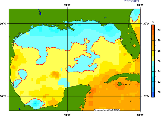
Even 100 miles offshore, sea surface temperatures are below 26 C (79 F). Compare this to August 31, 2008, the day before Gustav hit Louisiana:
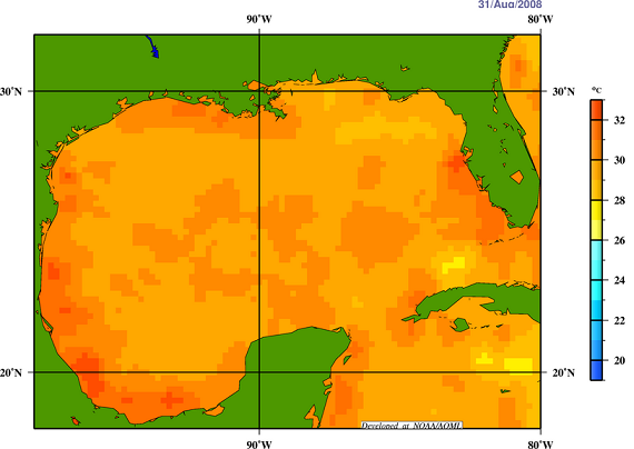
Then, water temperatures were 84 to 87 over most of the northern Gulf.
All that being said, there are waves over 12 feet high about 15 miles offshore, and the strong winds yesterday have built up a storm surge. A 3-5 foot storm surge can be expected along and east of the center, with the largest storm surge likely along the Alabama Gulf Coast and Mobile Bay, including Dauphin Island, Mobile, Daphne, Fairhope, Gulf Shores, and Orange Beach. These storm surges are much smaller than those during large storms like Ivan. Widespread areas from SE LA into S MS through S AL and NW Florida will have several hours of winds gusting to 30-50 mph, with trees going down and power outages. Heavy rains will occur, and some places may get over 8″. In general, though, unless something major changes, this should not be a catastrophic event with severe property damage, like Ivan or Katrina. People in mobile homes and low-lying areas near the coast need to take precautions.
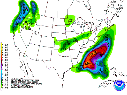
As far as effects on central Alabama… most models turn the storm sharply eastward toward south Georgia by Tuesday night. How much wind and rain we get in Birmingham will depend on how quickly the storm turns east. The consenus and NCEP indicate the heaviest rain will be from Pensacola to Anniston, including Montgomery, with 4-6″. Some spots may get more. Here in the BHM area, it looks like rain will move in tonight, and we’ll get 1-3″ of rain before the rain ends on Wednesday, with higher amounts SE (Alex City, Anniston, Talladega) and lower amounts NW (Jasper, Tuscaloosa). It will become windy tonight and tomorrow, with winds gusting as high as 35 mph on ridgetops around Birmingham, and maybe over 40 mph south of Clanton.
The UAH MAX (Mobile Alabama X-band radar) will be in Foley, AL, getting dual-Doppler coverage in cooperation with the NWS radar in Mobile.



