


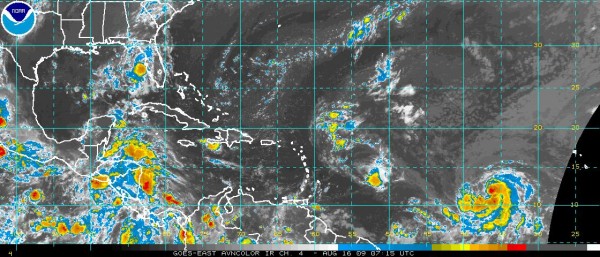
Here is the latest on our tropical trio: Ana, Bill and Claudette, in order of their proximity to Alabama…
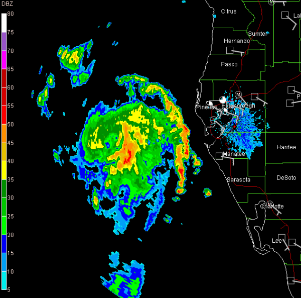
Yep. Looks like a tropical depression to me…
TROPICAL DEPRESSION FOUR FORMS IN THE GULF…
TROPICAL STORM WARNINGS ISSUED FROM ALABAMA/FLORIDA BORDER TO SUWANEE RIVER…
The tropical wave and upper low over the southeastern Gulf of Mexico has developed a closed circulation at the surface and is now officially a tropical depression. Top winds 35 mph. Movement is NNW at 16 mph. The forecast calls for a continued NW or NNW movement bringing the center to the Florida Coast as a tropical storm, likely between Destin and Panama City around sunset. Top winds are expected to be in the 50-55 mph range, although with low shear, it could conceivably approach hurricane force.
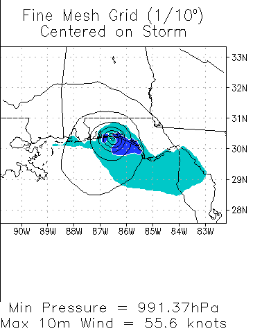
Here is the HWRF model, which shows a 991 mb tropical storm making landfall near Destin around about 7 p.m. tonight
Gulf waters are warm, and we can’t rule out more rapid strengthening than is forecast. Everyone along the Florida coast from the Big Bend area to Pensacola should pay attention to the latest advice on this system.
This system will significantly increase our rain chances here in Central Alabama starting Sunday night and continuing for Monday into Tuesday.
TROPICAL STORM ANA
I can just hear Arnold Schwarzenegger saying her name…AH-NA. Ana has taken a beating because of the fast low level flow she is bobbing along in. This shear has allowed the center to become exposed, with no real concentration of convection around it. It is moving west at 20 mph. Top winds are 40 mph. If it holds together as a tropical cyclone is will likely pass near the northern Leewards and Virgin Islands after midnight Sunday night, but it should not be a big problem.
TROPICAL STORM BILL STRENGTHENS A BIT
My namesake continues westward in the Atlantic some 1,500 miles west of the Windward Islands. It is moving west at 13mph. Top winds are 50 mph. The system gained convection overnight and should gradually intensify, becoming a hurricane in a day or so. A large trough is expected to develop over the eastern United States over the next week and this is expected to turn Bill north of the islands and allow it to stay east of the U.S. East Coast.
OFF TO BED FOR ONE OF JB’S POWER NAPS
Grabbing a little shut eye. Will be back with more updates by 7 a.m.



