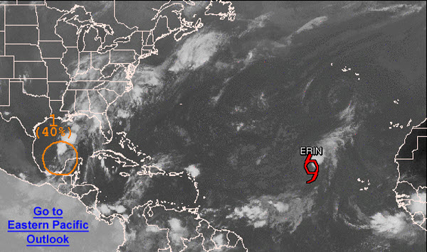
The latest look at the tropics still shows that we have two areas we are watching.
The first is in the eastern Atlantic, where Tropical Storm Erin remains a weak system. Winds are sustained at 40mph and she continues to move off towards the northwest. Erin will have a hard time strengthening as the system will be interacting with dry air and an unfavorable environment.
Closer to Alabama, an area of disturbed weather continues to move west-northwest across the southern Gulf of Mexico. It remains disorganized as most of the convection associated with it remains off to the north-northeast of the center of circulation. This system is sending ample moisture north towards the Gulf Coast and is making it anything but a nice weekend along the beaches. Flooding remains a major concern in these areas. The NHC gives the system a 40% chance of developing into a tropical cyclone the next 48 hours. It is expect to continue to move towards the lower Texas or Mexican Gulf Coast over the weekend.