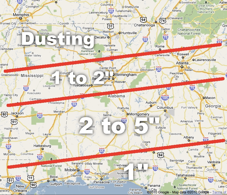
Based on radar/surface/upper air observations to the west, and the 12Z NAM, let’s revise the snow projections a bit. We will continue to adjust this as needed as the storm approaches. We do believe there could be isolated snow amounts to 6 inches over parts of South-Central Alabama, but we won’t be able to identify those spots until the snow bands set up tomorrow morning…