A pretty complex forecast faces us here in the weather department. Start with an approaching cold front sagging across Central Alabama, with a back door cold front nosing in from the east. The battle between these cooler airmasses and the warm, moist airmass to the south will dominate the weather across Alabama and the southeast this week.
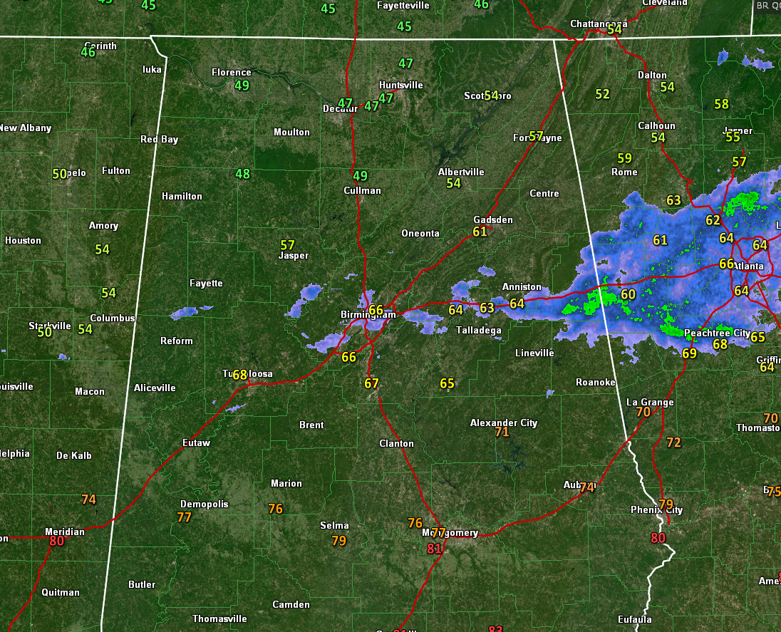
Temperatures will not be a single number affair today and tomorrow. It will depend on your position relative to the two fronts. Areas north and east of the two fronts will be in the 40s and 50s this afternoon. The 66F at Birmingham at 1 pm will likely start to fall slowly through the afternoon.
The showers are moving out, and tonight should be dry, although there could be a stray shower and some drizzle over eastern sections (east of I-65) as that back door front tries to nose in from Georgia. Lows will exhibit a wide range again, from 44F around Hamilton to 52F along I-20 to 60F across South Central Alabama.
Monday will be a mostly cloudy day. Temperatures will be in the upper 50s north to around 60F along I-59 to the 60s and 70s to the south and southeast. There could be a few stray showers, but most of the day and overnight should be dry. Lows Monday night will be more uniform, ranging from the upper 40s over eastern sections, to upper 50s and lower 60s elsewhere.
Tuesday: We will be watching that backdoor front over the east. Some recent indications are that it may strengthen and keep a cooler influence over eastern sections, at least early in the day. A surge of warmer, more moist air will take over during the day on Tuesday, putting all of the state back in the warm sector of a developing cyclone to our west by Tuesday night. Highs on Tuesday will range from the upper 50s and lower 60s north of US-278, with 70s elsewhere. Tuesday night lows will be in the 50s and 60s. Tuesday looks mostly dry to me now, although stray showers and storms will be possible again in the warm air pattern coming up from the south.
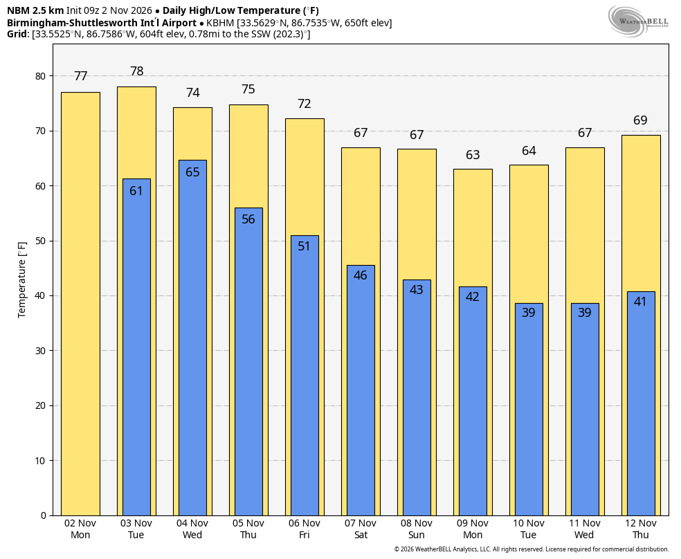
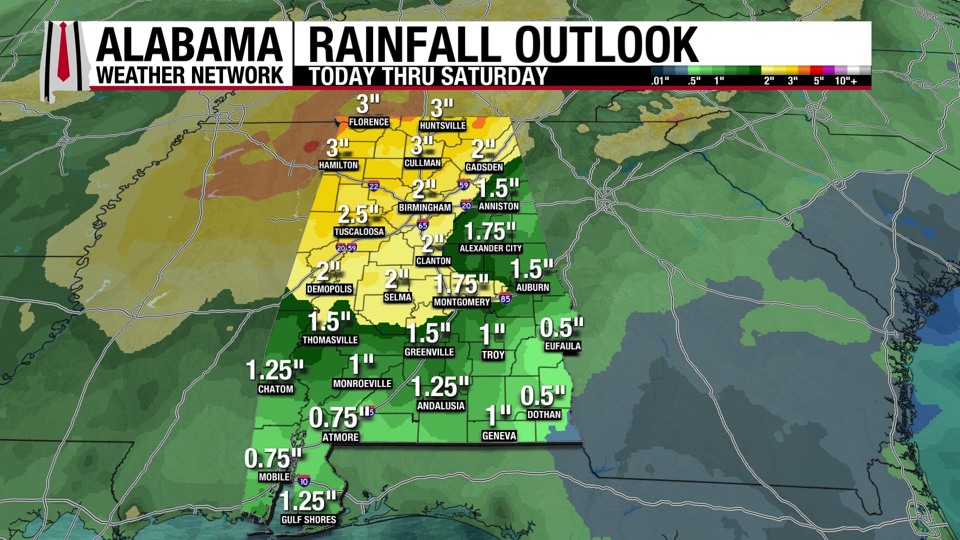
Wednesday will be warm and humid with a few showers and storms popping up. Thursday and Thursday night will feature dry, warm and humid conditions. Showers should start moving back into the picture Friday morning, with showers and storms becoming likely as the front pushes slowly into Alabama. It looks like it will be noon Saturday before the rain exits Central Alabama completely. Friday highs will be in the 70s. Friday night lows will range from the upper 40s over Northwest Alabama to middle 50s along I-20 to lower 60s to the south. Saturday will feature highs in the upper 50s North to middle 60s South. The main cold front will come in late Saturday into Sunday, causing temperatures to fall through the day into the 40s Sunday night. Sunday will be cool with highs in the lower 60s.