


Daily Weather Briefing
Saturday, March 14, 2026

ALABAMA THIS MORNING
A beautiful, cool Saturday morning greets the state of Alabama. Skies are clear, birds are chirping, and temperatures sit in the low to mid 40s statewide.
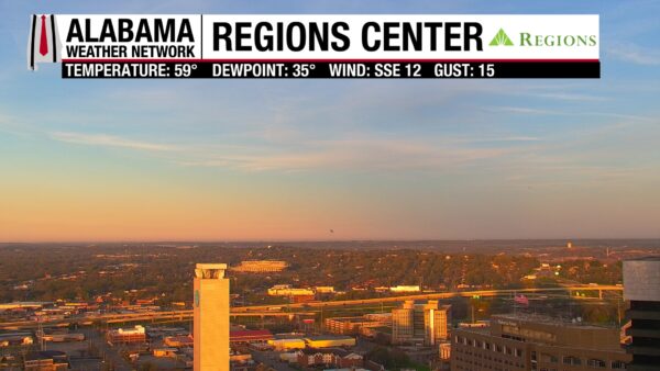
Light pink and orange hues show off on our Regions Skycams this morning.
ALABAMA 7 DAY FORECAST
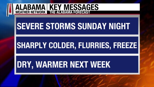
Today will be a warm, sunny, spring-like day. Sunday, isolated showers and thunderstorms are possible throughout the afternoon. Then a strong cold front enters the state Sunday night and traverses throughout the state through Monday morning. Damaging winds and a few tornadoes are possible. As the front exits the state, an arctic airmass rushes in, bringing temperatures to much below average for this time of year. A freeze is expected Monday night into Tuesday morning, and a warming trend does not begin until Wednesday.
WARM SPRING SATURDAY
High pressure over Alabama means clear skies and warm temperatures this mid-March Saturday. Highs will reach the mid 70s north and upper 70s to around 80 degrees in central and south Alabama. Get outside and enjoy the day today because our warm pattern is about to change quickly.
CLOUDS INCREASING OVERNIGHT
Southeasterly flow will encourage moisture advection into the state tonight. This will bring increasing clouds from south to north, as well as a few showers in southeast Alabama. Lows will be in the low to mid 50s statewide, except for the coast, which will sit around 60 degrees.
STORMY SUNDAY
Continued moisture advection will bring more clouds and showers to the state Sunday. A few isolated/scattered showers and thunderstorms are possible statewide Sunday, with a slightly higher chance in the south. Highs will reach the upper 70s north and the lower 80s centrally and in the south.
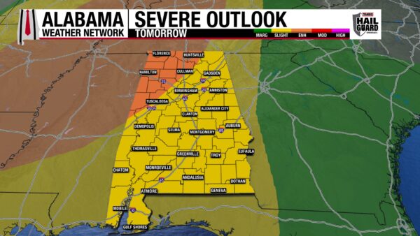
Then, the cold front enters the northwest corner of the state on Sunday night. It will move east/southeast throughout the night and is expected to reach southeast Alabama by 7 a.m. The front will materialize in the form of a line of strong thunderstorms, known as a QCLS or squall line. The Storm Prediction Center has placed the northwest corner of the state under an Enhanced Risk (3/5) of Severe Thunderstorms and the rest of the state under a Slight Risk (2/5). The northwest has the higher chance of seeing impacts, but both categories have the chance to see the same kind of impacts, such as damaging winds of 60-70 mph and spin-up tornadoes that could form from strong thunderstorms ahead of the line. It’s important to remember that this storm can be dangerous regardless of the tornado threat. 60-70 mph winds will knock down trees and power lines. The system will move quickly, minimizing the flooding threat. Make sure you have a way to receive warnings and download the Alabama Weather Network app so you can watch us live any time.
COOLING OFF MONDAY
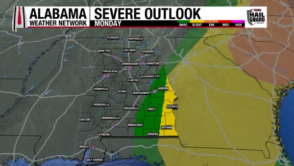
Before storms move out Monday morning, the SPC has placed the southeastern part of the state under a Slight and Marginal Risk (1/5) of receiving damaging winds and possible tornadoes. Meanwhile, north Alabama could see some flurries as temperatures drop and moisture sticks around. The snow will not stick, though, as we’ve been too warm recently. Then the state will clear and begin to cool. North and central Alabama will have longer to cool off, bringing their highs to only the low 40s to low 50s. South Alabama will be warmer, ranging from the mid 50s to low 60s. Winds will be gusty behind the front, making temperatures feel even colder.
COLDER TUESDAY
A freeze is expected statewide Tuesday morning as lows are expected to fall as low as the upper 20s and lower 30s statewide. Winter is not over yet, and its making sure we’re all aware of it! Highs Tuesday will be colder than Monday as the arctic airmass makes itself at home over the Southeast. They will sit in the mid to upper 40s north and the lower 50s in central and south Alabama.
WARMING TREND THROUGH REST OF THE WEEK
Although the visit from winter will pack a punch, it will be short-lived. A calm weather-warming pattern takes place in the latter half of the week.
Wednesday begins the warmup with highs in the upper 50s in the northeast portion of the state and the lower 60s everywhere else.
Thursday, highs will increase into upper 60s in the northeast and east and the lower 70s toward the west and southwest.
Friday continues the increasing warmth with highs in the lower to upper 70s statewide.
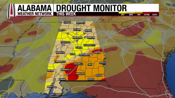
DROUGHT CONDITIONS BARELY BUDGE
Despite Wednesday’s heavy rains, Alabama’s drought conditions have barely changed. The entire state is experiencing some sort of drought conditions. The only category to see a decrease in area is Moderate Drought (D1), which caused an increase in both the Abnormally Dry (D0) and Severe Drought (D2) categories. This means that parts of the Moderate Drought area saw a slight improvement in conditions, while other parts of it saw their drought worsen.
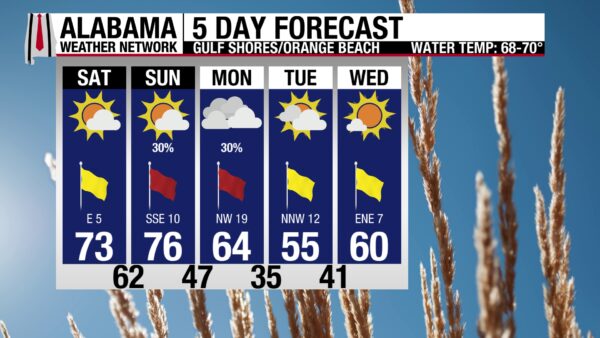
BEACH DAY!
Today is the perfect day to get outside and enjoy the beach. Highs will be in the low 70s, skies will be sunny, the UV Index will be high, and the winds will blow around 5 mph. Combine these conditions with a low rip current, a low surf height of one foot, and water temperatures in the upper 60s, and you’ve got a beautiful beach day! Make sure you soak up the warm rays from the sun while you can; it’s going to be cold on the coast at the beginning of the week!
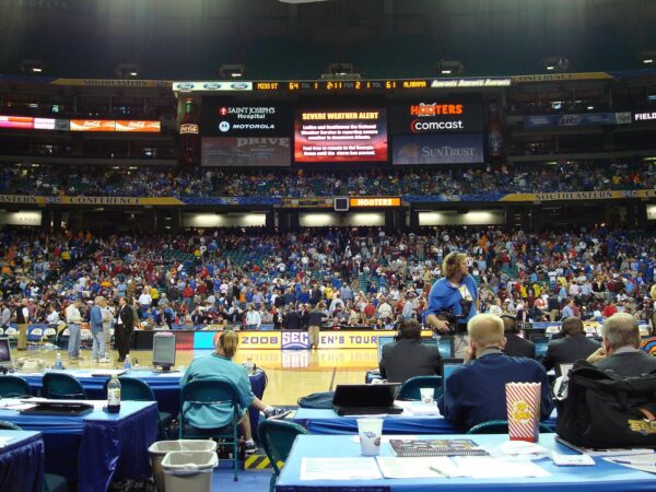
TODAY IN WEATHER HISTORY
March 14, 2008 – Tornado Strikes SEC Basketball Tournament
On March 14th, 2008, the Tide and the Bulldogs faced off in the SEC Basketball Tournament at the Georgia Dome in downtown Atlanta. A successful three-pointer led to a lucky avoidance of an otherwise likely post-game tragedy. Alabama’s player, Mykal Riley, hit a buzzer-beater three-pointer at the end of the regulation period, tying the score to 59-59. The basket sent the game into overtime, preventing what would have been thousands of fans- happy or sad- from pouring into the streets as an unwarned EF-2 tornado made its way into the city. Instead, a train-like rumbling began as Alabama again attempted to tie the game since Mississippi had scored in overtime. Fans, officials, and players froze, waiting for the parts of the ceiling to fall on top of them as they tried to deduce what the cause of the noise was. Some believed it was MARTA, Atlanta’s train system, a plane crash, or even a terrorist attack. Some knew the actual cause – a tornado. The winds tore off the fabric siding of a ceiling at a different end of the building, as well as caused other relatively minor damage to the Dome. The game was delayed by an hour, then Mississippi State won, knocking Alabama out of the tournament. The rest of the tournament was played at the Georgia Tech gym. The tornado killed one person, not in the Dome, when a building collapsed on them. That night, overall, however was very lucky that Riley made that shot. He may not have won the game from it, but he saved potentially thousands of lives.
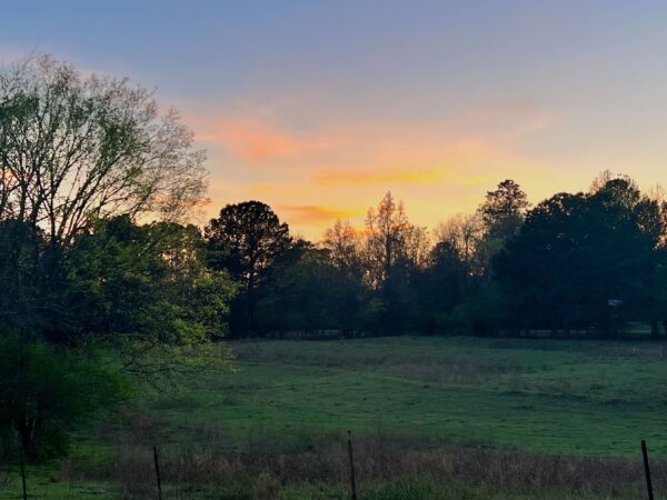
IMAGE OF THE DAY
Skywatcher Tyne Wingo sent in this serene sunset picture from Bagley yesterday.



