


The threat for severe has diminished with rain cooled air now in place across the severe thunderstorm watch area so the watch will be cancelled for Central Alabama counties.
But the threat for severe weather is not over.
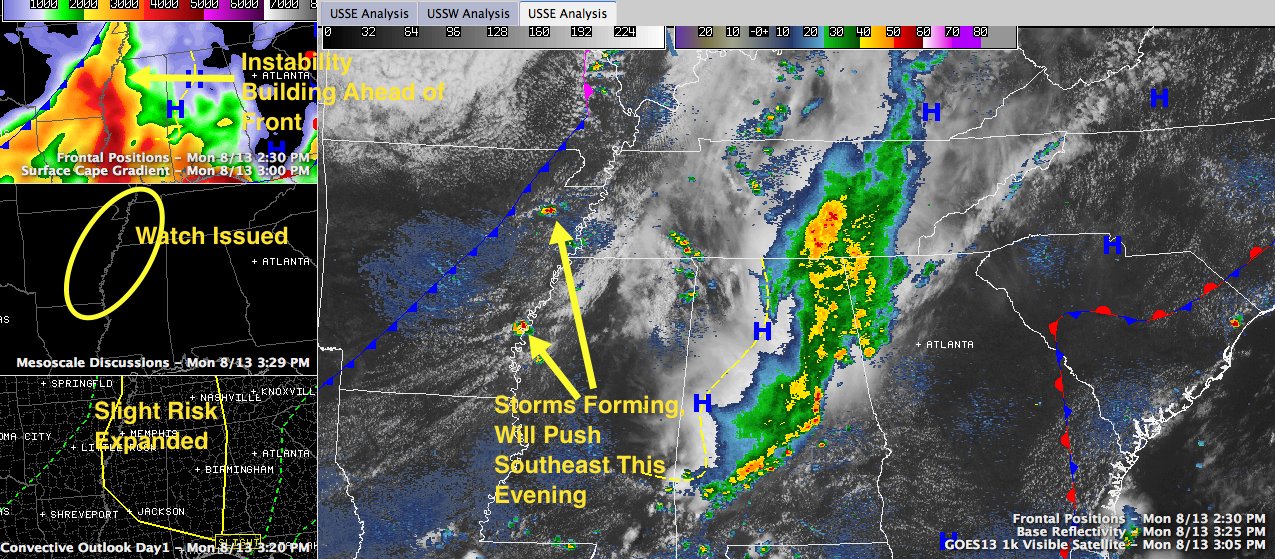
Click image to enlarge.
Storms are forming to our northwest over Arkansas and western Mississippi ahead of a cold front that is pushing southeast.
The SPC has just issued a severe thunderstorm watch for areas from southern Illinois and Indiana down to northern Louisiana and western Mississippi. This activity will affect Northwest and West Alabama later tonight. It remains to be seen whether it will make it into the I-59 corridor. The big question is whether our atmosphere can recover from the earlier storms.
Interestingly, the SPC has expanded the slight risk severe weather outlook area for the remainder of the afternoon and night to include areas ahead of the line of storms that is currently pushing eastward across South Central Alabama.



