


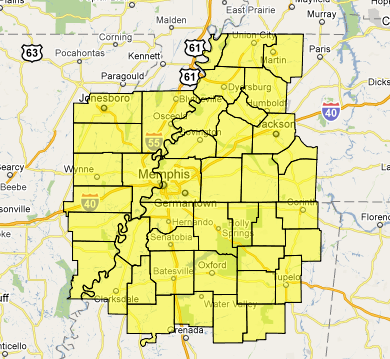
The NWS has extended the tornado watch for northern Mississippi, western Tennessee, Louisiana and Arkansas to the east ahead of a mesoscale convective complex that is move eastward.
Here is a radar image as of 7:40 p.m.
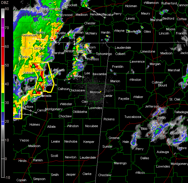
If it holds together, this storm complex will affect parts of West Alabama before 11 p.m. tonight. Instabilities are decent all the way across northern Mississippi. They drop off after you get into Alabama.



