


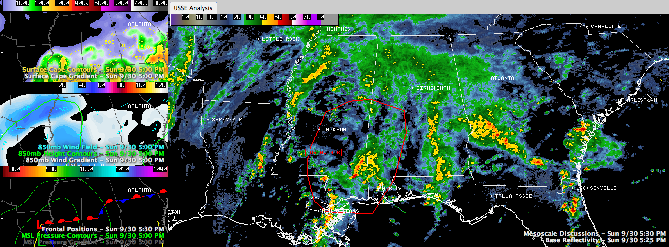
The SPC says a severe weather watch (almost certainly a tornado watch) may be required within the next hour for parts of West Central and Southwest Alabama.
You can see the area they are discussing outlined in red in the larger panel of the graphic. Click the graphic to enlarge it.
Moderate to heavy rain covers almost all of North Central Alabama this hour. The front extends from near Selma to Alex City at this hour. South of the front, in the warm sector, instabilities are increasing with CAPEs now 1,000-1,500 j/kg over Southwest and parts of South Central Alabama.
Storms east of Montgomery in the past few minutes have shown signs of organization. They are low topped and not likely to cause severe weather at this time, but as the airmass continues to destabilize and upper wind fields become more favorable for severe weather this evening that could change.
Severe weather will be possible tonight over West Central and Southwest Alabama and over the rest of the state on Monday. Please make sure you have your preferred method of receiving severe weather notifications on and ready tonight and tomorrow. We will have frequent updates here on AlabamaWX.com.
A FEW RAINFALL REPORTS
Just before 5 p.m., John Talbot reported the following…
…0.66″ at his location in Concord/Hueytown
…0.86″ from Brian Peters in Helena
…0.75″ from Richard Viola in Lake View
and 1.30″ from Ronald Hughes in Coker.



